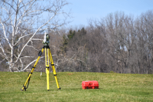
Professional land survey services for real estate transactions help identify physical evidence of property boundaries, show whether a fence, driveway, or shed appears to cross a boundary line, and map documented easements or potential encroachments before closing. In South Texas, a recorded deed describes what a property should include, but it does not always reflect current conditions on the ground. This discrepancy can raise title concerns and delay closings in Brownsville, Cameron County, and communities throughout the Rio Grande Valley.
Southpoint Geodetics, LLC provides professional land surveying services for real estate transactions throughout South Texas, from rural acreage in the Rio Grande Valley to narrow urban lots in the Brownsville area.
Common local surveying challenges include older legal descriptions, extended fence lines, missing or difficult-to-locate monuments, access easements, and unrecorded improvements.
Ordering a survey early gives buyers, sellers, lenders, real estate agents, and title companies documented evidence of property boundaries and improvements, along with time to resolve potential issues before closing.
Why an Accurate Land Survey Is Essential Before Closing
A professional land survey shows where property boundaries and improvements are located, helping buyers, sellers, lenders, and title professionals identify potential issues before closing.
Prepared by a licensed professional land surveyor, it may document:
-
Property lines and corner markers
-
Buildings, fences, sheds, and driveways
-
Access points and rights of way
-
Easements and visible utilities
-
Encroachments and other relevant site conditions
The surveyor develops these findings using recorded documents, field measurements, physical evidence, and applicable professional standards. The exact information shown depends on the requested scope.
A deed or listing description cannot reveal everything occurring on the ground. For example, a fence may have been treated as the boundary for decades without following the recorded property line. A garage, shed, or driveway may extend into an easement or onto an adjoining parcel.
Professional land survey services for real estate transactions can identify these conditions while the parties still have time to review them. The survey provides documented findings that title companies, lenders, attorneys, and neighboring owners can evaluate. Although a survey does not determine legal ownership or provide a legal opinion, it supplies physical evidence developed through recognized surveying methods.
The benefits vary by party:
-
Buyers can avoid relying on incorrect assumptions about boundary locations.
-
Sellers can address property questions before they disrupt closing.
-
Real estate professionals gain clearer documentation for guiding the transaction.
Choosing the Right Survey for the Transaction

The right survey depends on the property, intended use, transaction terms, and lender or title company requirements. A residential lot may not require the same scope as a shopping center, industrial tract, or large undeveloped parcel.
Before ordering, confirm what the requesting party expects to receive. Key factors include:
-
Legal description
-
Title commitment
-
Prior surveys
-
Proposed property use
-
Lender and title requirements
-
Closing schedule
Choosing the correct survey and scope at the outset can help prevent revisions, added costs, and delays later.
At Southpoint Geodetics, LLC, we review available information and explain the practical differences between survey types. Property owners and transaction professionals can also learn more about our survey services when evaluating the appropriate deliverable.
Boundary Surveys for Homes and Undeveloped Land
A boundary survey establishes or retraces a parcel’s limits using its legal description, recorded documents, field evidence, and applicable surveying standards.
The process generally includes:
-
Researching property and public records
-
Searching for existing monuments
-
Taking field measurements
-
Comparing field evidence with recorded information
-
Setting or restoring markers when appropriate
Boundary surveys are useful for homes, vacant lots, acreage, and rural tracts. They can clarify whether fences, driveways, outbuildings, and other improvements are located within the parcel. For undeveloped land, a boundary survey provides a reliable starting point before planning access, dividing property, placing improvements, or evaluating future use.
South Texas properties can present distinct challenges. Rural tracts near the Rio Grande Valley may rely on older descriptions, long fence lines, or difficult-to-locate monuments. Urban parcels around Brownsville may include narrow lots, alleys, utility easements, and improvements built close to property lines.
Local field knowledge helps surveyors interpret this evidence without assuming that visible occupation automatically establishes ownership.
ALTA/NSPS Surveys for Commercial Properties and Lender Requirements
An ALTA/NSPS Land Title Survey follows detailed national standards adopted jointly by the American Land Title Association and the National Society of Professional Surveyors. It combines boundary information with a broader review of conditions relevant to commercial title and due diligence.
Depending on the scope, an ALTA/NSPS survey may show:
-
Easements and rights of way
-
Access points
-
Buildings and parking areas
-
Visible utilities
-
Encroachments
-
Other conditions required by the standards
Optional Table A items may be added when negotiated by the client and surveyor. Because these items affect the scope, fee, and fieldwork, they should be selected before work begins.
Commercial buyers, lenders, title insurers, and attorneys commonly request ALTA/NSPS surveys. However, the exact requirements depend on the parties involved in the transaction.
Whenever possible, we coordinate the following before fieldwork:
-
Certification language
-
Title commitment
-
Supporting documents
-
Approved Table A items
Early coordination helps align the final survey with the transaction’s due diligence needs and reduces the likelihood of last-minute additions near closing.

What to Expect During a Professional Survey
A professional survey generally involves three stages:
-
Record review: The surveyor examines legal descriptions, plats, deeds, title documents, and other available records.
-
Fieldwork: The surveyor visits the property to locate evidence, find markers, and take measurements.
-
Analysis and delivery: Field findings are compared with the records, and the completed survey is reviewed, signed, and sealed when appropriate.
The surveyor can also explain identified discrepancies or concerns and recommend practical next steps. Explore more surveying resources.
Survey Costs, Timelines, and Common Causes of Closing Delays in South Texas
Survey cost depends on the work required—not acreage alone. A small urban parcel with conflicting historical records or dense improvements may require more research and fieldwork than a larger rural tract with clear boundaries and accessible monuments.
Factors affecting survey fees include:
-
Property location
-
Terrain and vegetation
-
Site access
-
Survey type and scope
-
Required certifications
-
Record complexity
-
Monument availability
-
Requested turnaround time
Timelines also vary. A straightforward residential boundary survey may move faster than a commercial or rural project requiring extensive research and field investigation. Weather, access restrictions, missing monuments, inconsistent legal descriptions, and delayed title documents can extend the schedule.
Common causes of closing delays include:
-
Ordering a survey without confirming the required type or scope
-
Providing an incomplete legal description
-
Sending the title commitment or easement documents late
-
Waiting until shortly before closing to authorize fieldwork
-
Discovering an encroachment or record conflict that requires review
-
Requesting new certifications or optional items after the drawing is prepared
Hiring a local South Texas land surveyor early and providing complete documents can help reduce delays. Early coordination is especially valuable for ranchland, resubdivided lots, and growing South Texas communities where older county records may intersect with newer residential or commercial development.
Buyers and transaction professionals should also allow time for the lender and title company to review the completed survey. When timing or scope is unclear, contact our South Texas surveying team to discuss the property, closing requirements, and available records.

Conclusion: Move Forward With Clear Property Information
Professional land survey services for real estate transactions provide a clearer picture of a property’s boundaries, improvements, easements, and potential concerns before commitments are finalized.
To reduce uncertainty and avoid preventable delays:
-
Select the appropriate survey type.
-
Confirm lender and title requirements.
-
Provide complete records early.
-
Allow enough time for fieldwork and review.
Southpoint Geodetics, LLC provides dependable property information to support informed, confident real estate decisions.
What are professional land survey services for real estate transactions?
Professional land survey services for real estate transactions involve measuring and documenting physical evidence of property boundaries in accordance with applicable professional standards. They provide important information about boundaries, visible improvements, and documented easements before closing.
Why is a land survey important when buying or selling property?
A land survey identifies physical evidence of property boundaries and shows visible improvements in relation to those boundaries. This information can reduce incorrect assumptions and help the parties identify potential boundary, encroachment, or easement concerns before closing.
What types of surveys are available for real estate transactions?
Common options include boundary surveys for homes and undeveloped land and ALTA/NSPS Land Title Surveys for commercial properties. Each survey is tailored to the property’s use, transaction requirements, and agreed scope.
How does an ALTA/NSPS Land Title Survey differ from a standard boundary survey?
An ALTA/NSPS survey follows national standards and combines boundary data with detailed information relevant to commercial title due diligence, including documented easements, rights of way, access, and visible utilities. A standard boundary survey focuses primarily on establishing or retracing property limits and showing relevant improvements within the requested scope.
How can I avoid delays in my real estate closing related to land surveys?
To help prevent delays, confirm the correct survey type early, provide complete legal descriptions and title documents upfront, authorize the survey well before closing, and coordinate with the surveyor regarding required certifications or optional survey items.
What factors influence the cost and timeline of a land survey?
The cost and timeline of professional land survey services for real estate transactions depend on property complexity, survey type, terrain, access, record clarity, required certifications, and fieldwork difficulty. A small urban parcel with conflicting historical records or dense improvements may require more research and fieldwork—and consequently cost more—than a larger rural tract with clear boundaries and accessible monuments.