
Land surveying services for real estate play a critical role in nearly every property transaction, yet many buyers, sellers, and agents aren’t sure what they involve or when they’re actually needed. Whether you’re purchasing your first home in the Rio Grande Valley, listing acreage near Harlingen, or representing a client closing on a commercial lot, understanding the basics of a land survey can save you from costly surprises down the road.
At Southpoint Geodetics, LLC, we see firsthand how a clear, accurate survey gives all parties the confidence to move forward. In this guide, we’ll walk through what land surveying services include, when they’re required, and how they protect your investment from start to finish.
What Are Land Surveying Services in Real Estate?
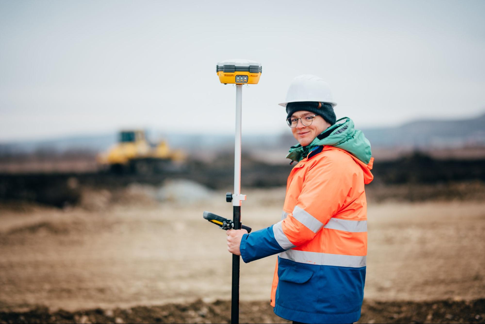
A land survey is a professional assessment that determines the exact boundaries, dimensions, and features of a piece of property. Licensed surveyors use a combination of fieldwork, legal records, GPS technology, and traditional measurement techniques to produce a detailed map or plat of the land.
In a real estate context, these surveys do more than just draw lines on paper. They confirm that what’s described in a deed or title actually matches what exists on the ground. That means identifying where fences sit, whether structures encroach on neighboring lots, and how easements or rights of way might affect the property.
For property owners and prospective buyers across South Texas, this kind of documentation is especially important. Many parcels in the region have histories that stretch back generations, and original markers or boundary lines may have shifted, been removed, or become unclear over time. A professional land survey cuts through that uncertainty and provides a reliable foundation for any transaction.
When You Need a Land Survey During a Real Estate Transaction

Not every real estate deal requires a survey, but many do. Here are some of the most common situations where a land survey becomes essential:
- Before purchasing property. Mortgage lenders and title companies frequently require a current survey before they’ll approve financing. This ensures the property boundaries are clearly defined and there are no encroachments or title issues lurking beneath the surface.
- Before selling property. Sellers who provide an up-to-date survey can speed up the closing process and reduce the chance of last-minute disputes.
- When building or making improvements. If you’re planning to add a structure, fence, or driveway, a survey confirms that your plans fall within your property lines and comply with local setback requirements.
- During boundary disputes. When neighbors disagree about where one property ends and another begins, a licensed surveyor’s findings carry legal weight.
Real estate agents working in the Brownsville and Harlingen areas often recommend surveys early in the process. It’s one of those steps that feels routine until it uncovers something unexpected, and by then, you’re grateful it was done. If you’d like to browse our blog for related topics, we cover many of these scenarios in greater detail.
Common Types of Surveys Used in Real Estate

The type of survey you need depends on the nature of your transaction and what your lender, title company, or local jurisdiction requires. Here are the most common types we handle:
Boundary Survey
This is the most straightforward type. It establishes the legal boundaries of a parcel, sets or restores corner markers, and identifies any encroachments. Boundary surveys are often required for property sales, subdivisions, and fence installations.
Mortgage Survey
A mortgage survey confirms the boundaries of a property being purchased and maps all improvements on the land. Lenders use this to verify that the property matches what they’re financing. It’s one of the most frequently requested surveys during residential closings.
ALTA/NSPS Land Title Survey
This is a more comprehensive survey that meets standards set jointly by the American Land Title Association and the National Society of Professional Surveyors. It incorporates boundary, topographic, and mortgage survey elements into one detailed report. Commercial transactions, title insurance policies, and large investments often require this level of detail.
Topographic Survey
While not always required for a standard sale, a topographic survey maps the terrain and physical features of a site. Engineers and architects rely on these when planning construction or evaluating drainage.
To explore the full range of services we offer, including farm and ranch surveys and as-built surveys, visit our services page.
How a Land Survey Protects Your Investment
A property purchase is one of the largest financial commitments most people will ever make. A land survey protects that investment in several important ways.
First, it confirms that you’re getting what you’re paying for. Without a survey, you’re relying on assumptions about where your property lines fall. Those assumptions can lead to expensive corrections later, whether it’s a fence that sits on a neighbor’s land or a shed that violates a setback requirement.
Second, surveys reveal easements, flood zones, and access issues that might not be obvious during a walkthrough. In South Texas, where development patterns vary widely from urban lots in Brownsville to rural tracts along the Rio Grande, these details matter.
Third, a current survey strengthens your position if a dispute ever arises. Boundary disagreements between neighbors are more common than people expect, and having a professional survey on file gives you documented evidence to support your claim.
At Southpoint Geodetics, LLC, we’ve helped property owners, real estate professionals, and builders build with confidence by providing clear, accurate documentation before problems have a chance to develop. That kind of prevention is always less expensive than resolution.
What to Expect: Cost, Timeline, and the Survey Process
One of the most common questions we hear is, “How much does a land survey cost, and how long will it take?” The honest answer is that it depends on the property.
Factors that influence cost include the size of the parcel, the type of survey required, the complexity of the terrain, and the availability of existing records. A straightforward mortgage survey on a residential lot will generally cost less than an ALTA/NSPS survey on a large commercial tract.
Timelines also vary. Many standard surveys can be completed within one to two weeks, though more complex projects may take longer. We always recommend scheduling your survey early in the transaction process so the results are ready well before your closing date.
Here’s a general idea of what the process looks like:
- Initial consultation. You share the details of your property and the purpose of the survey.
- Research. We review deeds, plats, and existing records related to the parcel.
- Fieldwork. Our team visits the property to take measurements, set markers, and document features.
- Deliverable. You receive a detailed survey map or plat along with any supporting documentation.
If you have questions about what type of survey fits your situation, feel free to reach out to our team. We’re happy to walk you through the options.
Conclusion
Land surveying services for real estate aren’t just a box to check during a transaction. They’re a practical tool for protecting your property rights, avoiding disputes, and making informed decisions at every stage of buying, selling, or building.
Whether you’re a first-time homebuyer, a seasoned agent, or a developer planning your next project in South Texas, understanding when and why to invest in a professional survey puts you in a stronger position.
At Southpoint Geodetics, LLC, we’re here to provide the accurate, reliable documentation that gives you clarity and confidence. If you’re preparing for a real estate transaction and want to know where a survey fits in, we’d be glad to help.
What Are Land Surveying Services for Real Estate?
Land surveying services for real estate define property boundaries, locate structures, and identify easements, encroachments, and legal access points. These services help buyers, sellers, lenders, and agents confirm that a property matches its legal description. A professional survey reduces uncertainty during a transaction and supports informed decisions. In real estate, accurate survey data can prevent disputes, protect investments, and keep closings on track.
When Should You Get a Land Survey for Real Estate?
You should get a land survey for real estate before buying land, building additions, installing fences, resolving boundary questions, or listing a property with unclear lot lines. Surveys are also common when lenders, title companies, or local authorities require updated property information. Ordering a survey early can reveal issues before closing, giving all parties time to address problems and avoid costly delays.
What Types of Land Surveys Are Used in Real Estate?
Common land surveys used in real estate include boundary surveys, mortgage surveys, ALTA/NSPS land title surveys, and topographic surveys. A boundary survey confirms property lines, while a mortgage survey gives lenders a general view of improvements and setbacks. ALTA surveys provide more detailed title-related information for commercial transactions. Topographic surveys map elevation and site features, which is useful for development, drainage, and planning purposes.
How Do Land Surveying Services Protect Property Buyers?
Land surveying services protect property buyers by confirming the exact boundaries and showing whether structures, driveways, fences, or utility lines cross onto neighboring land. A survey can also reveal easements, rights-of-way, and access limitations that may affect future use. By identifying these issues before closing, buyers can negotiate repairs, request documentation, or reconsider the purchase based on accurate and verified property information.
Can a Land Survey Help Prevent Boundary Disputes?
Yes, a land survey can help prevent boundary disputes by establishing a professional, legally supportable interpretation of the property lines. Surveyors compare recorded documents with field measurements to identify the correct boundaries. This makes it easier for neighbors, buyers, and sellers to understand where ownership begins and ends. Clear boundary information reduces misunderstandings and can be valuable evidence if a disagreement arises later.
How Much Do Land Surveying Services for Real Estate Cost?
The cost of land surveying services for real estate depends on the property size, terrain, location, record availability, and survey type. A simple residential boundary survey usually costs less than a detailed ALTA or topographic survey. Urgent turnaround times and difficult site conditions can also increase pricing. The best approach is to request quotes from licensed surveyors and compare scope, deliverables, and estimated completion times carefully.
How Long Does a Real Estate Land Survey Take?
A real estate land survey can take anywhere from a few days to a few weeks, depending on the survey type, property complexity, weather, and local record research requirements. Smaller residential lots are often completed faster than large, irregular, or heavily wooded parcels. Delays may also occur if deeds conflict or markers are missing. Hiring a surveyor early helps avoid timing issues that could affect closing schedules.
Who Should Order Land Surveying Services in a Real Estate Transaction?
Land surveying services in a real estate transaction can be ordered by buyers, sellers, lenders, title companies, developers, or real estate agents, depending on the situation. Buyers often order surveys for protection and due diligence, while sellers may provide one to support a smoother sale. In commercial deals, lenders and title insurers frequently request detailed surveys. The party ordering the survey should confirm the exact purpose first.
What Is Land Surveying in Real Estate?
Land surveying in real estate is the professional measurement and mapping of a property’s boundaries, dimensions, and physical features. It helps confirm legal property lines, identify improvements or encroachments, and ensure accurate land records for buying, selling, building, or resolving disputes.
What Does the Cost of a Land Survey Depend On?
Land survey costs depend on the property’s size, shape, location, terrain, accessibility, boundary complexity, and the type of survey required. Prices may also vary based on local regulations, the availability of existing records, and whether markers or disputes require additional research.
Can I Do a Land Survey Myself?
You can take basic measurements yourself, but a legal land survey usually must be completed by a licensed surveyor. Professional surveys are needed for official documents, permits, property transactions, and boundary disputes because they meet legal and accuracy standards.