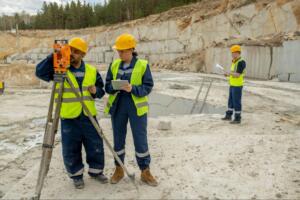

Development problems often begin long before equipment reaches a site. An unclear boundary, overlooked easement, incomplete title exception, or inaccurate elevation can affect design, permitting, construction, and project timing. That is why land surveying services for developers should be coordinated during due diligence rather than left until later stages.
At Southpoint Geodetics, LLC, we provide professional land surveying services throughout the Rio Grande Valley and South Texas. Our work helps developers understand existing property conditions, identify potential constraints, and provide reliable survey information for planning, design, construction, and project closeout.
Why Developers Need A Surveyor Before Making Major Decisions

A property’s acreage and address do not tell the full story. Developers may also need reliable information about legal boundaries, access, easements, encroachments, terrain, drainage features, and existing improvements before making major design or investment decisions.
Early survey work can reveal conditions that affect a proposed plan. An easement may cross a preferred building area, an existing fence may not align with the legal boundary, or elevation changes may influence grading and drainage. Identifying these conditions early can help reduce avoidable redesign and coordination later.
Surveyors provide measurements, mapping, boundary determinations, and professional survey documents. They do not determine zoning compliance or guarantee development approval, so developers should also coordinate with engineers, attorneys, planning officials, and other appropriate professionals.
Essential Land Surveying Services For Development Projects

The appropriate survey scope depends on the property, project stage, jurisdiction, and proposed development. Southpoint Geodetics works with clients to identify the information and deliverables needed for acquisition, design, approvals, construction, or closeout.
Boundary Surveys
A boundary survey establishes or retraces the legal boundaries of a property using deeds, plats, monuments, field evidence, and other relevant records.
For developers, accurate boundary information helps confirm the limits of the property before site plans or major improvements are finalized. A survey may also identify discrepancies involving fences, occupation lines, adjoining descriptions, or improvements near property boundaries.
ALTA/NSPS Land Title Surveys
An ALTA/NSPS Land Title Survey is commonly used in commercial real estate transactions involving buyers, lenders, title companies, and other parties that need detailed property information.
The 2026 ALTA/NSPS Minimum Standard Detail Requirements, effective February 23, 2026, establish the current national standards for these surveys. An ALTA/NSPS survey combines boundary information with specified title, easement, access, and improvement details. Additional information may also be requested through optional Table A items.
The current title commitment, requested Table A items, property information, and intended use should be coordinated before survey work begins.
Topographic Surveys
A topographic survey documents the horizontal and vertical characteristics of a site. Depending on the requested scope, it may include contours, elevations, pavement, buildings, drainage structures, visible utility features, trees, and water features.
This information provides engineers and architects with a measured base for grading, drainage, utilities, access, and site design. Across the Rio Grande Valley and South Texas, even relatively subtle elevation differences and drainage features may influence development planning.
Platting, Construction Staking, And As-Built Surveys

As a development moves from planning toward construction, additional surveying services may be needed to support approvals and field operations.
Subdivision Platting
Platting may be required when property is divided, combined, dedicated, or otherwise developed under applicable subdivision regulations.
A plat may identify lots, blocks, streets, easements, reserves, rights-of-way, and other required information. Requirements can vary by location and jurisdiction, so developers should confirm applicable city, county, or extraterritorial jurisdiction requirements early in the project.
Southpoint Geodetics can support the surveying components of the platting process while coordinating with the development team and relevant authorities as appropriate.
Construction Staking
Construction staking transfers information from approved design plans to physical locations on the site.
Depending on the agreed scope, survey crews may mark building locations, roads, utilities, drainage improvements, grades, or other planned features. Reliable staking also depends on current plans, appropriate survey control, clear site access, and communication when design revisions are issued.
Keeping the surveyor informed of the latest approved plans helps reduce conflicts and unnecessary restaking.
As-Built Surveys
An as-built survey documents selected locations, dimensions, or elevations of completed improvements.
These surveys may be used during construction or project closeout to document installed conditions. Required features, tolerances, and intended uses should be identified in advance because owners, engineers, contractors, lenders, and government agencies may have different documentation requirements.
How Surveyors Support Each Stage Of Development
 Surveying often supports several phases of a development project rather than one isolated task.
During site evaluation and acquisition, surveyors can research property records, determine or retrace boundaries, and document existing conditions. This gives developers a more reliable understanding of the site before major design or investment decisions are made.
During design and entitlement, survey information provides engineers and architects with a measured base for grading, drainage, utility, access, and site plans. Surveyors may also prepare plats, easement exhibits, legal descriptions, or other survey-related documents when required.
During construction, staking helps contractors locate planned improvements using approved dimensions and elevations. Clear communication becomes especially important when construction sequencing or design revisions change.
During project closeout, as-built measurements can document selected completed conditions for review, coordination, or recordkeeping.
What Affects Land Surveying Costs And Timelines?
Survey pricing depends on the work required rather than acreage alone. A small property with conflicting records, dense improvements, or difficult access may require more work than a larger open site.
Common factors that can affect cost and scheduling include:
- Parcel size, shape, terrain, vegetation, and accessibility
- Availability of deeds, plats, monuments, and prior surveys
- Boundary complexity and adjoining property information
- Title exceptions and requested ALTA/NSPS Table A items
- Number and type of topographic features to be located
- Required research, fieldwork, drafting, and professional review
- Jurisdictional review procedures
- Construction schedules, mobilizations, and plan revisions
Weather and field conditions can also affect scheduling. Heavy rainfall, standing water, dense vegetation, locked gates, active construction, or inaccessible survey control may slow field operations.
Developers can help reduce avoidable delays by providing current title information, available plans, site contacts, access instructions, and a clear description of the requested deliverables.
How Developers Can Prepare Before Requesting A Survey
Developers do not need every project detail finalized before contacting a surveyor, but providing available information can make the scoping process more efficient.
Useful materials may include the property address or legal description, current title commitment, prior surveys, proposed development plans, site contacts, governing jurisdiction, important project deadlines, and specific lender or agency requirements.
For an ALTA/NSPS Land Title Survey, current title information and requested Table A items should also be coordinated early. Clearly identifying the intended use of the survey can help the surveyor determine an appropriate scope of work.
Why Work With Southpoint Geodetics?
Development projects rely on accurate information and survey work that supports the needs of the project team. Southpoint Geodetics, LLC provides professional surveying services throughout the Rio Grande Valley and South Texas for residential, commercial, and development-related properties.
Our services include boundary surveys, topographic surveys, ALTA/NSPS Land Title Surveys, engineering-related surveys, as-built surveys, and other surveying support. By involving our team early, developers can define the appropriate scope and keep survey information aligned with the next stage of the project.
Conclusion

Effective land surveying services for developers create an important connection between property records, design plans, and actual site conditions.
Starting survey coordination early can help developers identify constraints, define appropriate deliverables, and make planning decisions using measured information rather than assumptions. It can also give engineers, architects, contractors, title professionals, and other members of the project team a more reliable foundation for their work.
Southpoint Geodetics supports projects throughout the Rio Grande Valley and South Texas from due diligence and design through construction and closeout.
Planning a development project? Contact Southpoint Geodetics to discuss your property, project stage, available documents, and the survey services needed to keep your next steps moving forward.
Why Are Land Surveying Services Important For Developers During Early Project Stages?
Land surveying helps developers understand property boundaries, easements, elevations, terrain, access, and existing improvements before design advances. Early survey information can reveal conditions that may affect site planning or development decisions.
What Types Of Surveys Are Commonly Needed For Development Projects?
Common services include boundary surveys, ALTA/NSPS Land Title Surveys, topographic surveys, subdivision platting, construction staking, and as-built surveys. The appropriate services depend on the property, proposed development, and project stage.
When Should A Developer Hire A Land Surveyor?
Survey coordination should ideally begin during due diligence or early site evaluation. This gives the project team time to identify property conditions before major design or construction decisions are finalized.
How Does Construction Staking Support A Development Project?
Construction staking transfers approved design information to marked locations on the site. Depending on the project, surveyors may mark buildings, roads, utilities, drainage improvements, or grades according to the agreed scope.
Can A Land Surveyor Guarantee Zoning Compliance Or Development Approval?
No. Surveyors provide measurements, boundary determinations, mapping, and professional survey documentation. Zoning compliance and development approval are determined by the applicable authorities and may require input from engineers, attorneys, planners, and other professionals.
What Factors Influence The Cost And Timeline Of A Development Survey?
Cost and timing may be affected by parcel size, accessibility, terrain, available records, boundary complexity, title exceptions, requested features, jurisdictional requirements, weather, construction activity, and plan revisions.