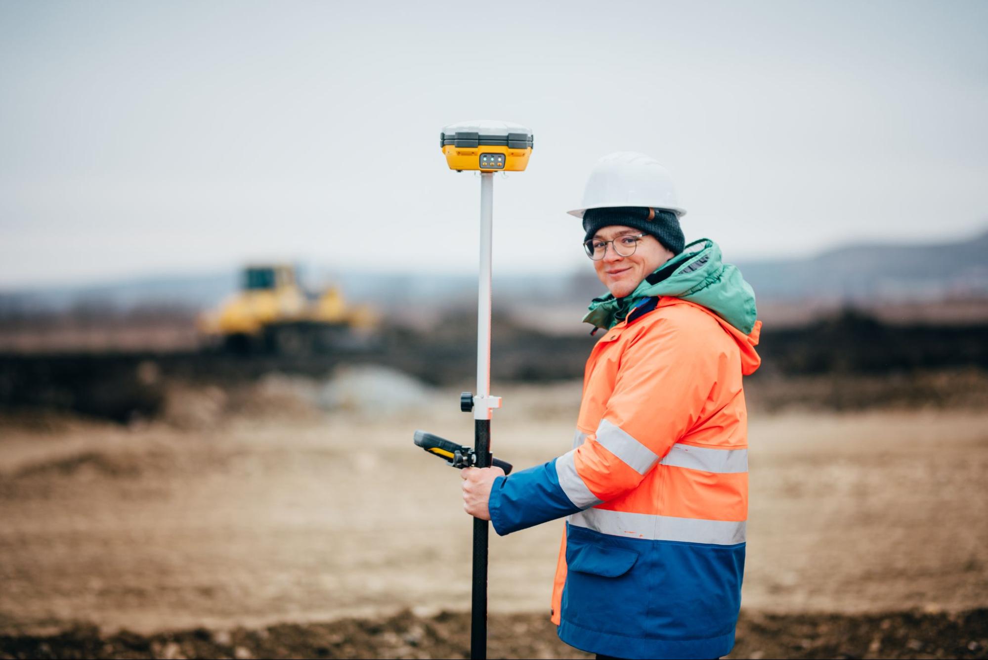
Closing a real estate transaction in the Rio Grande Valley involves more moving parts than most buyers and sellers expect. One of the most critical, and most overlooked, is the land survey. Mortgage brokers and lenders require surveys that meet specific standards before they will approve a loan, and delays in obtaining the right survey can push back a closing by days or even weeks. Southpoint Geodetics services are designed to deliver precise, lender-ready surveys that RGV professionals depend on to keep transactions on track and meet underwriting requirements without surprises.
What Lenders Actually Require From a Survey

Lenders require surveys to verify that the property securing a loan is exactly what the title documents say it is. They need to confirm boundary lines, identify encroachments, and flag any easements or right-of-way issues before funds are released. A survey that does not meet the lender’s specifications will stall the closing process and may require a full re-survey at additional cost.
Most residential mortgage lenders in Texas require a survey that meets the standards of the Texas Society of Professional Surveyors or specific requirements outlined by the title company. Commercial lenders typically require an ALTA/NSPS Land Title Survey, which is one of the most detailed survey types available. Getting the right survey type from the start prevents costly back-and-forth between the lender, title company, and surveyor.
The Role of Boundary Surveys in Residential Closings
A boundary survey establishes the exact legal limits of a property. For residential transactions, this is often the foundational document a title company and lender need to confirm the property’s physical extent matches its legal description.
In the RGV, where subdivisions have grown rapidly and older properties sometimes have records that predate modern recording standards, boundary accuracy is especially significant. A missing corner, an overlapping fence line, or an undocumented easement can slow or stop a loan approval. Catching these issues early in the transaction, rather than at the closing table, gives all parties time to resolve them without derailing the deal.

ALTA/NSPS Surveys for Commercial and Investment Properties
Commercial lenders and title insurers routinely require an ALTA/NSPS Land Title Survey. This survey type combines boundary data with information about improvements, easements, utilities, zoning, and access, all in a format that meets national standards set by the American Land Title Association and the National Society of Professional Surveyors.
An ALTA survey gives lenders and investors a thorough picture of the property before closing. It reduces the risk of title claims and gives all parties a shared, verified reference point. For mixed-use developments, industrial sites, and multi-family projects across the RGV, this level of detail is not optional. It is required.
Elevation Certificates and Flood Zone Compliance
A significant portion of the Rio Grande Valley sits in or near FEMA-designated flood zones. Lenders financing properties in these areas must require flood insurance, and the premium for that insurance is determined in part by an Elevation Certificate.
An Elevation Certificate documents the elevation of the lowest floor of a structure relative to the Base Flood Elevation. An accurate certificate can reduce flood insurance premiums substantially. An inaccurate or missing certificate can delay the loan or result in higher insurance costs that affect the buyer’s ability to qualify.
Why Southpoint Geodetics Services Are Built for Lender Standards
Southpoint Geodetics services are performed under the license of Michael Wood, RPLS, who is licensed in both Texas and Mississippi. Every survey delivered meets the standards required by Texas lenders, title companies, and national underwriters.
The firm is locally owned and based in Harlingen, which means it has direct knowledge of RGV property conditions, flood plain maps, and local subdivision histories. That local knowledge reduces errors and speeds up the research process that precedes every field survey.

How Survey Errors Cause Closing Delays
Survey errors cause closing delays when lenders or title companies find discrepancies between the survey and the property’s legal description or title commitment. Common issues include incorrect acreage, undisclosed encroachments, or missing easements that affect the lender’s collateral position.
When these issues surface late in the closing process, everyone pays. The buyer may face an extension fee on their rate lock. The seller loses time on the market. The broker and agents spend hours managing a problem that accurate survey work would have prevented. Prevention is far less expensive than correction.
Working With Title Companies Across the RGV
Title companies are often the first to request a survey, and they have specific requirements for what a survey must include and how it must be certified. A surveyor who is not familiar with those requirements will produce a document that requires revision.
Southpoint Geodetics works regularly with title companies throughout the Rio Grande Valley, including those handling transactions in Harlingen, McAllen, Brownsville, and the surrounding communities. Familiarity with local title requirements means surveys are submitted in the format and with the certifications that title companies need the first time.
What Mortgage Brokers Should Know Before Ordering a Survey
Mortgage brokers should order a survey as early as possible in the transaction timeline. Waiting until the week before closing to initiate a survey creates unnecessary pressure and leaves no room to address issues discovered during the survey process.
Brokers should also confirm with the title company what survey type is required for the specific transaction. Residential and commercial loans have different requirements, and mixed-use or agricultural properties may add another layer of complexity. Providing that information to the surveyor upfront keeps the process efficient.
The Value of a Licensed, Local RGV Surveyor
Licensing is not optional for land surveyors in Texas. Every survey must be signed and sealed by a Registered Professional Land Surveyor. Working with a licensed, locally based firm provides both legal standing and regional expertise.
Learn more about Southpoint Geodetics and the experience behind every survey we produce. Michael Wood, RPLS, brings years of field and research experience to every project, and the firm’s roots in the RGV mean our work reflects the specific conditions and requirements of this region.
Conclusion: Keep Your Closings on Track With Southpoint Geodetics Services
Delays at the closing table cost everyone time and money. The right survey, ordered early and produced by a licensed professional who understands lender requirements, removes one of the most common causes of those delays. Southpoint Geodetics services are designed to give mortgage brokers, lenders, and title companies exactly what they need, without the back-and-forth that slows transactions down. If you are preparing a transaction in the Rio Grande Valley and need a survey that meets lender standards, request a quote from Southpoint Geodetics today. Call us at (956) 368-5074.
What types of surveys do mortgage lenders require in Texas?
Most residential mortgage lenders in Texas require a boundary survey that meets state standards, while commercial lenders typically require an ALTA/NSPS Land Title Survey. The title company handling your transaction will usually specify which type is needed. Confirming the requirement before ordering avoids delays caused by submitting the wrong survey type.
How does an Elevation Certificate affect a mortgage in the RGV?
An Elevation Certificate is required by lenders when a property is located in a FEMA flood zone. It documents the structure’s elevation relative to the Base Flood Elevation, which determines flood insurance premiums. A certified, accurate Elevation Certificate can lower insurance costs and keep the loan qualification process from stalling over flood compliance.
How early in a real estate transaction should a survey be ordered?
A survey should be ordered as early as possible, ideally at the same time the title search begins. Early ordering gives the surveyor time to research records, complete fieldwork, and address any issues before the closing date approaches. Last-minute survey orders are one of the most common causes of closing delays in RGV real estate transactions.
Why does Southpoint Geodetics have an advantage in the Rio Grande Valley?
Southpoint Geodetics is locally owned and based in Harlingen, giving the firm direct knowledge of RGV flood maps, subdivision records, and title company requirements. Every survey is produced under the license of Michael Wood, RPLS, who is licensed in Texas and Mississippi. That combination of local knowledge and professional licensing makes the firm a reliable resource for lenders and brokers across the valley.
What is the difference between a boundary survey and an ALTA survey?
A boundary survey identifies the legal limits of a property and is typically used for residential transactions. An ALTA/NSPS Land Title Survey goes further, documenting improvements, easements, utilities, and other details in a nationally standardized format. ALTA surveys are required for most commercial loans and provide lenders with a much more detailed picture of the property before closing.