When a real estate transaction stalls because a survey is missing, every day counts. Title companies and mortgage brokers across the Rio Grande Valley know that searching online for a “Southpoint Geodetics near me” result and hoping for the best is not a strategy. It is a risk. Southpoint Geodetics is a locally owned, RPLS-licensed firm based in Harlingen, TX, founded by Michael Wood. We serve the entire RGV with direct communication, local knowledge, and the kind of reliability that keeps closings on schedule.
Why Local Surveys Are Different in the Rio Grande Valley

The RGV presents land surveying challenges that firms outside the region often underestimate. Colonia boundaries, irrigation district easements, flood zone designations, and complex deed histories are routine here, not exceptions.
A surveyor who knows this region can read a title commitment, identify potential issues early, and flag problems before they reach the closing table. That saves everyone time, including the lender, the title agent, and the buyer.
Local knowledge is not optional in South Texas. It is what separates a survey that closes a deal from one that creates a chain of follow-up questions.
What Title Companies Actually Need From a Survey
Title companies need accuracy and clear documentation. A survey that raises more questions than it answers creates liability and delays.
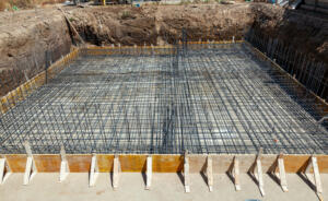
At minimum, most residential transactions require a Mortgage Survey, sometimes called a Spot Survey. This shows the location of structures, fences, and improvements relative to the property boundary. It confirms that the house is actually on the lot being sold.
More complex deals require an ALTA/NSPS Land Title Survey, which meets national standards and satisfies both the lender and the title insurer. We handle both types across the RGV.
What Mortgage Brokers Need to Know Before Ordering a Survey

Mortgage brokers are often the first to realize a survey is needed, and they rarely have time to vet multiple vendors. The loan package has a deadline, and the survey has to match the legal description in the title commitment exactly.
We work directly with lenders and brokers to confirm what type of survey the underwriter requires. That prevents ordering the wrong product and having to start over.
One call to (956) 368-5074 puts you in contact with our team, not a call center. You get a straight answer on scope, cost, and scheduling.
Why “Southpoint Geodetics Near Me” Beats a Generic Surveyor Search
Typing “surveyor near me” into a search engine returns results based on proximity, not expertise or availability. You may find a firm that is geographically close but booked out, unfamiliar with RGV-specific title requirements, or not licensed for the survey type you need.
The better approach is to call a firm you already know serves your area, understands your transaction type, and has a track record in the region. That is exactly what professionals across Hidalgo, Cameron, and Willacy counties do when they call Southpoint Geodetics.
Survey Types We Provide for Closing-Related Transactions
Our land surveying services cover the full range of survey types required in residential and commercial closings.
Mortgage Surveys confirm structure locations and are required by most lenders for residential purchases. ALTA/NSPS Surveys meet the detailed standards required for commercial transactions and high-value residential deals. Boundary Surveys establish and mark the legal limits of a property and are often required when a title commitment reveals a boundary discrepancy.
We also provide Topographic Surveys for development projects and Subdivision Platting services for land developers. If you are not sure which survey type your transaction requires, call us and we will point you in the right direction.
Serving the Entire Rio Grande Valley
Southpoint Geodetics is based in Harlingen, and we serve clients throughout the RGV, including Brownsville, McAllen, Mission, Edinburg, Weslaco, Pharr, San Benito, and surrounding communities.
This geographic reach is practical for title companies managing transactions across multiple counties simultaneously. You do not need a different vendor for a property in Cameron County versus one in Hidalgo County. One relationship covers the region.
Regional coverage also means our field crews are familiar with local terrain, access conditions, and municipal requirements that affect scheduling and fieldwork.
How Southpoint Geodetics Is Built for Professional Clients

We built this firm to serve professionals, not just homeowners calling for the first time. That means clear communication, accurate quotes upfront, and documentation that meets lender and title standards without revision requests.
Michael Wood, RPLS, leads the firm with licensure in both Texas and Mississippi. You can learn more about our background and credentials on our about Southpoint Geodetics page.
When title officers and mortgage brokers refer clients to us, they are putting their own reputation behind the referral. We take that seriously.
Conclusion
For title companies and mortgage brokers in the Rio Grande Valley, finding a reliable survey partner should not require a search. Southpoint Geodetics near me is more than a search phrase. It is a direct answer: we are here, we are local, and we know what your transactions require.
Call (956) 368-5074 or request a quote today. We will confirm the right survey type for your transaction and give you a clear picture of scope and cost from the first conversation.
What types of surveys does Southpoint Geodetics provide for real estate closings?
Southpoint Geodetics provides Mortgage Surveys, ALTA/NSPS Land Title Surveys, and Boundary Surveys for residential and commercial closings. We also provide Topographic Surveys and Subdivision Platting for development projects throughout the Rio Grande Valley. Call (956) 368-5074 to confirm which survey type your lender or title company requires.
Does Southpoint Geodetics serve the entire Rio Grande Valley?
Yes. We serve clients across Cameron, Hidalgo, and Willacy counties, including Harlingen, Brownsville, McAllen, Edinburg, Mission, Weslaco, and San Benito. Title companies managing transactions in multiple RGV counties can work with a single, consistent survey provider rather than coordinating with multiple firms.
How do I know which survey type my transaction requires?
Your title commitment or lender instructions typically specify the required survey type. If those documents are unclear, call us directly at (956) 368-5074. We will review the transaction details and help you identify the correct survey product before you place an order, preventing delays from ordering the wrong type.
Is Southpoint Geodetics licensed in Texas?
Yes. Southpoint Geodetics is led by Michael Wood, a Registered Professional Land Surveyor (RPLS) licensed in both Texas and Mississippi. All surveys are performed and certified under that license, meeting the standards required by Texas title companies, mortgage lenders, and underwriters operating in the Rio Grande Valley.
Why do title companies prefer calling Southpoint Geodetics over searching online?
Title companies prefer calling us because they get a direct answer from someone familiar with RGV title requirements, not a generic quote form. We understand what lenders and title insurers require, we serve the full region, and we communicate clearly from the first call through final delivery.
What is an ALTA/NSPS Survey and when is one required?
An ALTA/NSPS Land Title Survey is a detailed survey that meets national standards set jointly by the American Land Title Association and the National Society of Professional Surveyors. Lenders and title insurers typically require one for commercial property transactions and high-value residential deals where standard mortgage surveys do not satisfy underwriter requirements. If your lender or title commitment specifically asks for an ALTA survey, that is the product you need, and we produce them across the RGV.
Can a homebuyer order a survey directly, or does it have to go through the title company?
A homebuyer can order a survey directly. In practice, many buyers coordinate with their title company or lender first to confirm what type of survey the transaction requires before placing an order. Either way, calling us at (956) 368-5074 is the fastest way to clarify scope and cost so the right survey gets ordered the first time.
What happens if a survey reveals an encroachment or boundary discrepancy?
A survey documents existing conditions on the ground. If our survey reveals an encroachment, an overlapping fence line, or a boundary that does not match the deed description, we report those findings clearly in the survey documentation. What happens next is a decision for the parties involved, their title company, and their attorneys. We do not provide legal advice, but we do provide accurate, defensible documentation that gives everyone the facts they need to move forward.
How does topographic surveying differ from a boundary or mortgage survey?
A topographic survey maps the elevation and physical features of a property, including grades, drainage patterns, trees, and existing structures. Boundary and mortgage surveys focus on property lines and improvement locations for ownership and lending purposes. Developers, engineers, and architects typically request topographic surveys at the start of a project to inform site design and grading plans. We provide both types throughout the Rio Grande Valley.
Does Southpoint Geodetics handle subdivision platting for land developers?
Yes. We provide Subdivision Platting services for developers dividing land into lots for residential or commercial development. Platting requires coordination with local municipalities and county offices, and our familiarity with RGV jurisdictions, including requirements in Cameron, Hidalgo, and Willacy counties, keeps that process moving without unnecessary back-and-forth. Contact us early in the development process to confirm requirements for your specific project location.