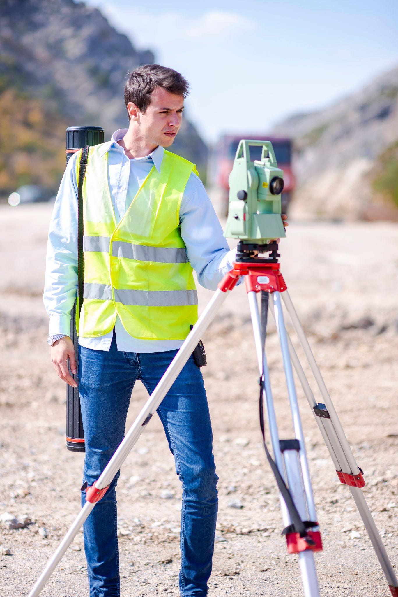
Timing is everything in commercial development and subdivision planning. Yet one of the most common — and costly — mistakes we see across the Rio Grande Valley is waiting too long to book a land surveyor. By the time engineers are finalizing designs or developers are pushing for permits, a survey that should have happened weeks earlier becomes an emergency. That delay ripples through every phase of a project: financing, design, permitting, and construction. Southpoint Geodetics works with developers and engineers throughout Harlingen and the surrounding Valley to help projects stay on track from the start. This article covers the real-world mistakes we see most often — and how early surveying prevents them.
Mistake #1: Treating the Survey as a Last-Minute Checkbox
A land survey is not a formality to handle the week before breaking ground. It is foundational data that every other professional on your project relies on — engineers, architects, lenders, and municipal planners. When a survey gets ordered too late, you may receive results that conflict with assumptions already built into your design documents. That means redesigns, resubmittals, and added cost. Booking a land surveyor early means your team is working from accurate boundary, elevation, and easement data from day one, not scrambling to adjust plans mid-stream.
Mistake #2: Assuming a Previous Survey Is Still Valid
Older surveys may be on file for a property, but they are not always reliable for current development purposes. Boundary monuments shift. Easements get recorded after the original survey date. Properties get subdivided or recombined. Texas also has specific requirements for survey currency depending on the type of transaction or project. Relying on an outdated survey — especially for commercial projects in fast-growing areas like the Rio Grande Valley — can expose your project to serious boundary disputes, permitting rejections, or lender concerns.
Mistake #3: Skipping a Topographic Survey Before Site Design
Engineers designing drainage, grading, and infrastructure need accurate topographic data. Without it, they are estimating. Estimating leads to redesigns once field conditions contradict assumptions. A topographic survey captures existing ground elevations, drainage patterns, and physical features across your site. In the Rio Grande Valley, where flat terrain can hide subtle drainage problems, this step is especially critical. Getting topo data before site design begins — not after — keeps your civil engineering grounded in reality.
Mistake #4: Not Accounting for FEMA Flood Zone Complications
A large portion of the Rio Grande Valley sits in or near FEMA-designated Special Flood Hazard Areas. Flood zone status directly affects financing, insurance, and construction requirements. A Flood Elevation Certificate — which requires a licensed surveyor — may be needed before a lender approves your loan or before a municipality issues a permit. Discovering this requirement after you have started design adds weeks of delay that could have been avoided by looping in a surveyor during the earliest stages of due diligence.
Mistake #5: Miscommunicating Easement Locations to Your Design Team
Easements for utilities, drainage, or access can significantly affect where you can build. If your design team is working from a plat or deed description without a current field survey, they may not know where those easements physically exist on the ground. A surveyor locates and maps those easements precisely so that your engineers and architects are designing within the actual buildable area. Getting this information wrong early means expensive corrections later — or worse, conflicts with utility companies or neighboring property owners during construction.
Mistake #6: Underestimating Subdivision Platting Lead Time
For residential or commercial subdivision projects in Hidalgo, Cameron, or Willacy counties, subdivision platting requires survey work as part of the approval process. Municipal and county platting review can take time, and the survey itself must meet specific standards before submission. Developers who start thinking about platting after they have already committed to a project timeline often find themselves in a scheduling bind. Bringing a surveyor in during the feasibility stage gives you a realistic picture of what the platting process will require and how long it will take.
Mistake #7: Ordering the Wrong Type of Survey for the Project
Not all surveys serve the same purpose. A boundary survey, an ALTA/NSPS survey, a topographic survey, and a construction staking survey are each designed for different needs. Ordering the wrong one — or an insufficient one — for your project type wastes money and delays results. For example, a commercial lender financing a major retail development will likely require an ALTA/NSPS survey, which has specific standards that a basic boundary survey does not meet. Talking through your project needs with a qualified surveyor early prevents mismatched expectations. Review our full land surveying services to understand what each survey type covers.
Mistake #8: Waiting Until a Problem Surfaces
Survey issues rarely announce themselves in advance. A boundary encroachment, an unrecorded easement, or a discrepancy between the legal description and the physical property can sit quietly until construction begins — and then bring everything to a halt. Proactive surveying during due diligence is far less expensive than reactive surveying after a problem has already affected your schedule, your budget, or your relationships with contractors and lenders.
Book a Land Surveyor Before Your Project Gets Ahead of Itself
The cost of waiting is almost always higher than the cost of the survey itself. Whether you are planning a commercial development in Harlingen, a subdivision in the Valley, or working through the early stages of an engineering project, the right time to book a land surveyor is earlier than you think. Learn more about Southpoint Geodetics and our work across the Rio Grande Valley, or take the first step and request a quote from Michael Wood, RPLS. We are here to help your project move forward on solid ground. Call us at (956) 368-5074.
What types of projects require a land survey in the Rio Grande Valley?
Commercial developments, subdivision platting, residential construction on undeveloped lots, land purchases, and any project requiring permits or lender financing typically require some form of land survey. The specific type depends on your project scope, your lender’s requirements, and local jurisdiction rules. Talking with a licensed surveyor early helps you identify exactly what you need.
How early in a project should I book a land surveyor?
Ideally, during the due diligence or feasibility phase — before design work begins. Survey data informs engineering, architecture, financing, and permitting. The later you bring a surveyor in, the more likely their findings will require costly revisions to work that is already underway.
What is the difference between a boundary survey and an ALTA/NSPS survey?
A boundary survey establishes the legal boundaries of a parcel and locates improvements relative to those boundaries. An ALTA/NSPS survey meets a national standard required by many commercial lenders and title companies — it includes additional details about easements, encroachments, and other matters affecting title. Commercial real estate transactions often require ALTA/NSPS surveys specifically.
Does Southpoint Geodetics handle subdivision platting in multiple counties?
Yes. Southpoint Geodetics works on projects across Hidalgo, Cameron, and Willacy counties, among others in the Rio Grande Valley region. Each county and municipality may have different platting requirements, and we are familiar with those local processes.
What happens if I rely on an old survey for a new project?
An outdated survey may not reflect current boundary monuments, easements, or title conditions. Lenders, title companies, and permitting agencies may reject it outright. More seriously, design decisions made on inaccurate information can create legal and financial complications that are far more expensive to resolve than a current survey would have been.