It can feel like a black box to try to get a professional land surveying services quote if you have never been through the process before. At Southpoint Geodetics, we believe property owners, Realtors, and developers deserve a clear picture of what goes into pricing before they commit. Your quote depends on several project-specific factors, and understanding them can help you plan with more confidence. This guide explains the main variables that commonly affect survey costs across the Rio Grande Valley and South Texas.
Property Size and Shape Affect the Base Cost
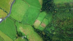
Larger properties generally require more time in the field and more work in the office. A two-acre residential lot typically takes less effort to survey than a 200-acre agricultural tract with irregular boundaries.
Irregular shapes also add complexity. A parcel with many corners, curves, or non-orthogonal lines requires more calculations and may require more monuments to be found, verified, or set.
Simple rectangular lots are often less expensive to survey than irregular or heavily constrained parcels. Acreage and parcel geometry are two of the first details a licensed surveyor will ask about when preparing your quote.
Survey Type Determines Scope and Deliverables
The type of survey you need has a direct effect on cost. A boundary survey identifies the surveyor’s professional opinion of property lines based on record research and field evidence. A topographic survey records elevation and surface features. An ALTA/NSPS Land Title Survey follows national standards and is often requested in commercial real estate transactions.
Each type requires a different level of fieldwork, research, and documentation. If you are unsure which survey type applies to your project, you can learn more about our survey services to see the full range commonly needed across South Texas, from residential lot surveys to subdivision platting.
Knowing which survey type is being requested by your lender, title company, municipality, or project team before you call can help you get a more accurate quote faster.
Existing Records and Title History Affect Research Time
Before a surveyor steps on your property, research happens. Deed descriptions, plat maps, county records, and prior survey data usually must be located and reviewed.
A clear title history with a recorded plat and reliable prior surveys can reduce research time. Vague, conflicting, or older metes and bounds descriptions often take longer to interpret and can add to the cost.
In parts of South Texas, older land grants and historical legal descriptions can add further complexity. Properties with that kind of history may require additional investigation before fieldwork can begin.
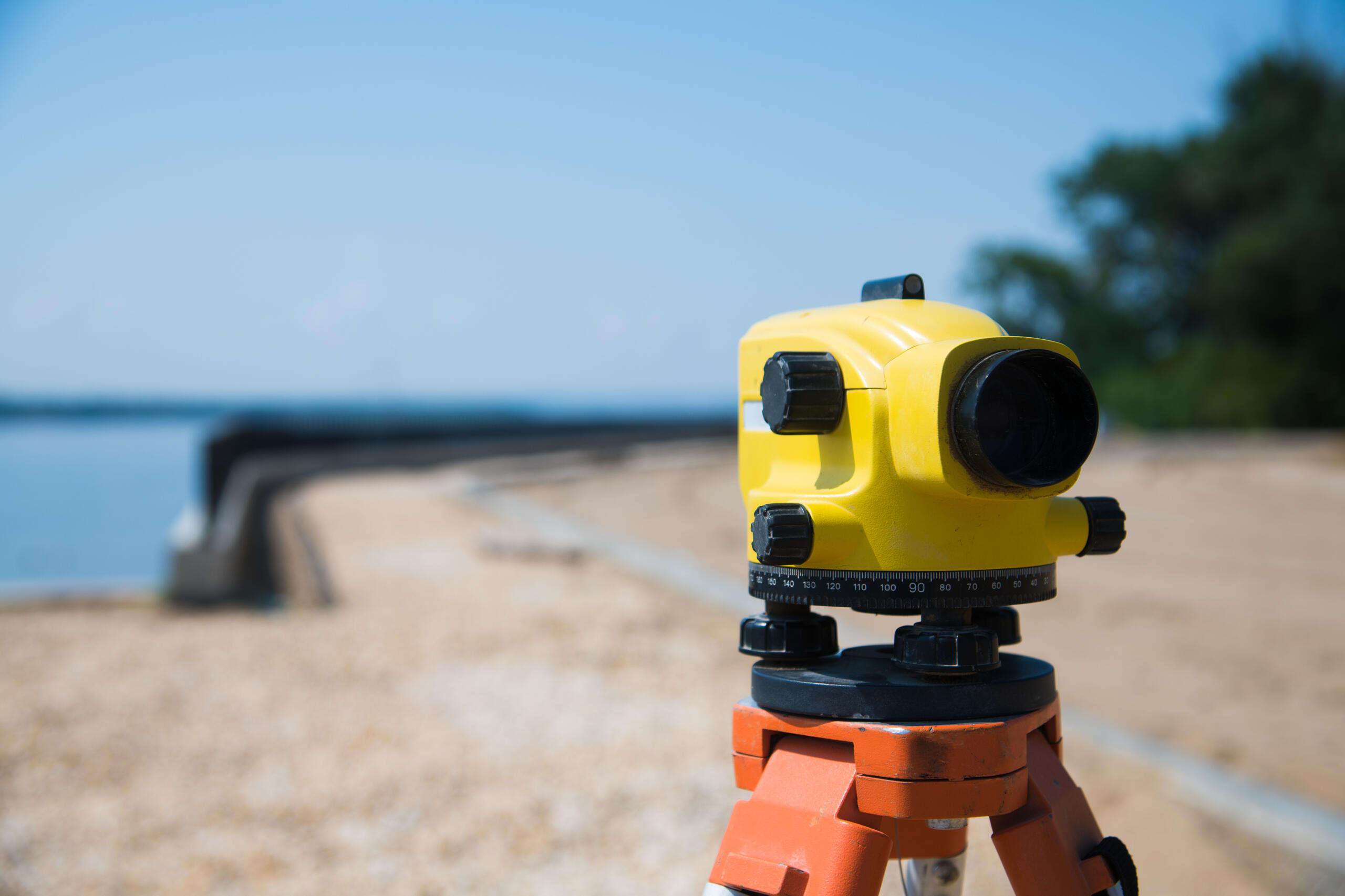
Field Conditions in South Texas Can Affect Survey Time
The terrain and vegetation across the Rio Grande Valley vary widely. Flat, open farmland is generally easier to work in than sites with dense brush, irrigation canals, fencing, or livestock.
Accessibility also plays a role. A corner monument located in standing water, along a steep bank, or behind private infrastructure may take more time and equipment to reach.
These are variables your surveyor accounts for when preparing a quote, not reasons to avoid getting one. If you have questions about how site conditions might affect your project, you are welcome to contact us to discuss your property before requesting a formal quote.
Monumentation Requirements Can Add to Costs
Setting or replacing corner monuments is often part of a boundary survey. The number of corners that need to be set, and the type of monument required or appropriate for the job, can affect both material cost and field time.
If existing monuments are found in good condition and can be verified, that may reduce the work required. If they are missing or disturbed, the surveyor may need to set or reference additional monumentation, depending on the scope of work and applicable standards.
Ask your surveyor specifically about monumentation when reviewing your quote so there are no surprises in the final scope.
Platting and Filing Fees Are Often Separate
If your project involves subdividing land or creating a new legal description through a plat, filing fees, application fees, and review times are often separate from the surveyor’s professional fee. These vary by county and municipality across the Valley.
Hidalgo, Cameron, Willacy, and Starr counties each have their own submission processes and fee schedules. A surveyor can help you understand what to expect, but those costs are typically separate project expenses.
Including them in your overall project budget from the start can help prevent unexpected expenses later.
Turnaround Urgency Can Affect Scheduling and Pricing
Rush requests sometimes require a surveyor to rearrange scheduling, add crew time, or prioritize your file ahead of other projects. That flexibility can affect pricing.
Standard project timelines allow time for research, fieldwork, drafting, and quality review. Projects scheduled in the normal rotation are often more cost-efficient.
If your closing date or permit deadline is firm, communicate that early so your surveyor can discuss realistic scheduling options.
Working With a Licensed Surveyor Protects Your Investment
In Texas, final surveying documents issued as professional land surveying work generally must be signed, sealed, and dated by a licensed Professional Land Surveyor in accordance with TBPELS rules. If a survey is being used for a closing, permitting, or legal purpose, confirm the specific requirements with the requesting party.
At Southpoint Geodetics, Michael Wood is licensed in Texas and Mississippi and oversees project quality and accuracy. Property owners, Realtors, and developers across the Rio Grande Valley can browse our blog for related topics covering survey types, title considerations, and what to expect throughout the process.
Hiring a licensed professional helps the survey align with professional standards and improves the likelihood that it will meet lender, title, or agency requirements.
Get a Clear Quote Based on Your Project
Your professional land surveying services quote reflects real variables, including property size, survey type, research complexity, field conditions, and project requirements. At Southpoint Geodetics, we provide a clear, honest quote based on the specifics of your project. If you are ready to move forward, request a quote today. You can also call us at (956) 368-5074 with any questions.
What Should I Look for When Booking a Professional Land Surveying Service?
Look for a licensed Professional Land Surveyor with local experience in your county. A reputable surveyor asks questions about your property before quoting, confirms which survey type you need, and explains the deliverables you will receive. You can verify licensing through the Texas Board of Professional Engineers and Land Surveyors (TBPELS) before signing any agreement.
How Much Does It Cost to Hire a Professional Land Surveyor?
Survey costs vary based on property size, survey type, research requirements, and field conditions. Simple residential surveys generally cost less than large tracts, commercial projects, or subdivision platting. The most accurate way to get a figure is to contact a licensed surveyor directly with your property details and let them assess the specific scope of work.
How Long Does a Professional Land Survey Take to Complete?
Project timelines vary depending on research requirements, field crew availability, scheduling, and any issues discovered during the work. Some residential boundary surveys may be completed within several business days, while others take longer depending on scheduling, research, and site conditions. If you have a firm deadline, communicate it early so your surveyor can discuss scheduling options and set realistic expectations.
What Types of Land Surveys Do Professional Surveyors Offer?
Professional surveyors typically offer boundary surveys, topographic surveys, construction staking, ALTA/NSPS Land Title Surveys, and subdivision platting, among others. The right type depends on your specific need, whether you are buying property, securing financing, obtaining a permit, or developing land. A licensed surveyor can help you determine which survey type is appropriate and whether a lender, title company, or municipality has specific requirements.
Do I Need a Professional Land Survey Before Buying or Selling Property?
A survey is not always legally required to close a real estate transaction in Texas, but it is often recommended. Without one, you may not know where property lines fall, whether encroachments exist, or whether the legal description matches what is on the ground. Many lenders and title companies request a survey as part of the closing process, especially when no recent acceptable survey is available or when boundary issues may affect title coverage.