When you are buying, selling, or building on property in South Texas, a licensed land surveyor often becomes essential faster than you expect. Lenders, title companies, and city or county offices rely on surveys to confirm exactly what you own, where you can build, and whether there are any issues that might delay your plans.
Southpoint Texas Surveying understands these decisions carry real financial and emotional weight. In this guide, we explain what a licensed land surveyor does, why licensing matters, and when you should involve a surveyor so you can move forward with confidence.
Discover What a Licensed Land Surveyor Actually Does
A licensed land surveyor is more than someone who comes out with a GPS unit and a tripod. Their work ties directly into property law, construction standards, and local regulations.
Defining a Licensed Land Surveyor
A licensed land surveyor is a state-regulated professional who measures, maps, and interprets land boundaries and physical features. In Texas, surveyors must meet education and experience requirements and pass licensing exams before they can sign and seal official survey documents.
In practical terms, a licensed land surveyor can:
- Research your property’s history using deeds, plats, and county records
- Locate and verify boundary markers, such as iron rods or concrete monuments
- Measure distances, angles, and elevations with modern instruments and proven methods
- Compare field measurements with legal descriptions to identify the true boundary
- Prepare maps and legal descriptions that stand up to review by title companies, lenders, and courts
The goal is always the same. A licensed land surveyor provides a clear, defensible picture of your property so you are not relying on assumptions, fence lines, or older sketches that may no longer be accurate.
Common Types of Surveys for Homes and Land

Most South Texas property owners encounter a licensed land surveyor in one of a few common situations. The type of survey you need depends on what you are trying to do.
Boundary Survey
A boundary survey establishes or re-establishes the exact lines of your property based on its legal description. We locate existing markers or set new ones, measure the property against deed calls, and show the boundary on a survey drawing with fences, buildings, and visible encroachments.
Mortgage or Title Related Surveys
When you are buying property with financing, the lender and title company often require a survey. This type confirms boundaries and shows improvements such as the house, driveway, sheds, and easements. At Southpoint Texas Surveying, we routinely perform mortgage-related surveys that help buyers, sellers, agents, and lenders move toward a smooth closing.
ALTA/NSPS Land Title Surveys
For many commercial properties in South Texas, an ALTA/NSPS Land Title Survey is requested. This detailed survey follows national standards so that title companies, attorneys, and lenders know they are all relying on the same level of information.
Topographic and Engineering Surveys
Before construction, engineers and architects often need a detailed view of the land’s surface. Topographic and engineering surveys show elevations, drainage patterns, utilities, and other features that influence design.
If you would like to see how different survey types fit into real projects, you can explore the full range of services we offer.
Protect Your Investment With Proper Licensing
In Texas, only a licensed land surveyor can legally certify a land survey that is used for real estate transactions, permitting, or court matters. Licensing protects property owners by setting a clear standard for competence and accountability.
State Requirements and Professional Standards
Licensed land surveyors in Texas must meet strict requirements, including formal education, supervised field experience, and rigorous examinations. Once licensed, surveyors are held to state rules and professional ethics that govern how surveys are researched, measured, and documented.
Your survey should:
- Be based on a thorough review of deeds, plats, and adjoining properties
- Use recognized measurement methods and calibrated equipment
- Clearly show boundaries, improvements, and any encroachments discovered
- Include a professional seal and signature that confirm responsibility for the work
These standards are especially important in South Texas, where older deeds, irrigation canals, and changing development patterns can make boundary interpretation more complex.
Risks of Using Unlicensed or Outdated Surveys
Using an unlicensed individual or an outdated survey to guide major property decisions can create real problems:
- Delayed closings when a lender or title company rejects an old or unsigned survey
- Costly construction changes if a fence, driveway, or building is later found over the line
- Boundary disputes with neighbors that require legal action to resolve
- Confusion about easements that may limit where you can build
We always recommend a current, sealed survey from a licensed land surveyor whenever you are making a significant decision about your land.
Know Exactly When You Need a Licensed Land Surveyor
Property owners across South Texas often ask us when they actually need to involve a licensed land surveyor. Although every situation is unique, there are patterns we see again and again.
Buying or Selling a Home
When you buy or sell a home, especially with a mortgage, a current survey is usually expected. A licensed land surveyor helps confirm that improvements sit within the boundaries, show any encroachments, and identify easements that may affect how you use the property.
Many buyers feel more comfortable investing when they can see a clear, current picture of the property on paper. If you are exploring these topics further, you can browse our blog for articles that walk through specific survey types in more detail.
Building, Remodeling, or Adding Fences and Driveways
Before you pour a foundation, extend a driveway, or install a new fence, it is wise to know exactly where the line is. A licensed land surveyor can mark boundary corners, help you avoid building inside setback lines or recorded easements, and provide documentation for future reference.
In fast-growing parts of South Texas, a current survey keeps your project aligned with local requirements and helps you avoid unexpected corrections or stop-work orders.
Large Tracts, Ranches, and Rural Properties
Farm, ranch, and rural tracts bring additional complexity. Old fence lines do not always match deed descriptions. Creeks and resacas may have shifted over time. Access easements may not be clearly marked.
On these properties, we use historical records, modern GPS equipment, and on-site observation to clarify total acreage, locate existing monuments, and identify roads, gates, and easements that affect access and future use.
Find the Right Licensed Land Surveyor for Your Needs
Choosing a licensed land surveyor is similar to choosing other professional advisors. You want someone who understands your type of property, communicates clearly, and delivers accurate work on time.
Questions to Ask Before You Hire
Before you authorize a survey, consider asking:
- Have you worked on properties similar to mine in this part of South Texas?
- What type of survey do you recommend for my situation?
- What information do you need from me to get started?
- What is included in your quote, and what might change the final cost?
- When do you expect to have the final survey ready?
Checking Credentials, Experience, and Insurance
Confirm that the person signing your survey is a licensed land surveyor in Texas. You can ask for the license number and verify it through the state. Also ask how long they have been practicing in the region, whether they carry professional liability and general liability insurance, and whether they are familiar with local city and county requirements.
At Southpoint Texas Surveying, we encourage property owners to ask these questions. If you would like an overview of the different survey types we provide, you can learn more about our South Texas land surveying services.
Navigate Cost, Timing, and the Survey Process With Ease
Cost and timing are two of the biggest concerns for property owners. Knowing what to expect from a licensed land surveyor can reduce stress and help you plan your next steps.
What Drives the Cost of a Survey
Survey pricing is not one-size-fits-all. Several factors influence cost: property size, terrain and vegetation, availability and clarity of existing records, number of improvements to show, and travel time to the site.
A small city lot with clear records usually costs less than a large brush-covered ranch tract with limited documentation. When we provide a quote, we base it on the effort required to produce an accurate, defensible survey.
Typical Timelines and How to Avoid Delays
Most residential boundary or mortgage-related surveys take from several days to a few weeks, depending on workload and complexity. You can help avoid delays by sharing prior surveys, title documents, or plats you have, ensuring gates are unlocked, and letting us know about any known disputes or past issues with neighbors.
What to Expect on Survey Day and Afterward
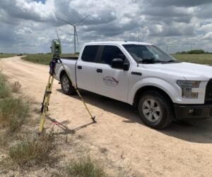
On survey day, you may see a crew using GPS equipment, tripods, and measuring rods. They will locate visible boundary markers, measure distances and angles, and note improvements such as buildings, fences, and driveways.
After field work, the licensed land surveyor reviews the data, compares it to the legal description, and prepares a survey drawing showing boundary lines, corner monuments, structures, visible encroachments, and easements provided in the title documents. Your final product will be a sealed survey you can share with your title company, lender, builder, or local permitting office.
Build Stronger Partnerships With Your Survey Team
A licensed land surveyor is one part of a team that often includes your real estate agent, title company, and lender. When everyone works from the same clear information, transactions tend to move more smoothly.
How Survey Results Affect Closings and Loans
Lenders and title companies rely on your survey to answer practical questions: Is the house located on the described property? Are there any encroachments that create risk? Are recorded easements shown, and do they affect the use of the property?
If the survey is current and clearly prepared, it helps the title company issue title insurance and helps the lender finalize the loan documents.
Dealing With Boundary Issues or Title Exceptions
Sometimes a survey uncovers issues such as a fence crossing the property line, a building sitting partially inside a setback, or easements that limit planned improvements.
In these cases, it is important not to panic. The survey’s role is to reveal the situation so that attorneys, title professionals, and property owners can decide how to handle it. We work closely with other professionals to explain our findings in clear terms. If you have questions about a specific situation on your property, you can reach out to our team to discuss your needs.
Conclusion

Property decisions in South Texas are too important to leave to guesswork. A licensed land surveyor gives you a clear, legally reliable understanding of your land so you can buy, sell, or build with greater confidence and fewer surprises.
Whether you are purchasing your first home, planning a new project, or managing a ranch, choosing a qualified licensed land surveyor is one of the simplest ways to protect your property rights and avoid preventable disputes.
If you are ready to take the next step, you can explore the full range of services we offer, browse our blog for additional resources on specific survey types, or contact us to discuss your property and the survey that fits your situation.
Licensed Land Surveyor FAQs
What does a licensed land surveyor do for my property in South Texas?
A licensed land surveyor measures and maps your property’s boundaries and physical features, researches deeds and plats, verifies or sets boundary markers, and prepares official survey drawings and legal descriptions. Lenders, title companies, and permitting offices rely on this work to confirm what you own and where you can legally build.
When should I hire a licensed land surveyor when buying or selling a home?
You should involve a licensed land surveyor early in the buying or selling process, especially if a mortgage is involved. A current survey confirms boundary lines, shows the house and improvements, identifies encroachments or easements, and gives lenders and title companies the documentation they need for a smooth closing.
Why is it risky to use an old or unlicensed land survey for my project?
Old or unlicensed surveys can lead to rejected closings, costly construction changes, and boundary disputes. Fences, improvements, and plats may have changed over time. Only a current, sealed survey from a licensed land surveyor provides a defensible picture of your property that lenders, title companies, and courts are willing to rely on.
How do I choose the right licensed land surveyor for my property?
Ask whether they have surveyed properties similar to yours in your area, what type of survey they recommend, what information they need from you, and what is included in the quote. Confirm their Texas license number, experience in the region, and that they carry appropriate insurance and understand local city and county requirements.
How much does a land survey typically cost in Texas?
Land survey costs in Texas vary widely based on property size, terrain, access, and record clarity. A simple city lot may cost a few hundred dollars, while large or heavily vegetated rural tracts can run into the thousands. Request a written quote that explains what is included and any factors that could increase the fee.
What is the difference between a land surveyor and a civil engineer?
A land surveyor focuses on accurately determining and documenting property boundaries, easements, and site features for legal and title purposes. A civil engineer designs infrastructure such as roads, drainage, utilities, and foundations. On many projects they work together: the surveyor provides precise site data, and the engineer uses it for design and permitting.