Affordable land survey services in South Texas can still reflect careful work and professional standards — and choosing the right survey helps support one of the largest investments most people make.
Few things raise questions during a property transaction more than: what will the survey involve, and how reliable will the results be?
At Southpoint Geodetics, LLC, we believe affordable land survey services in South Texas should reflect appropriate care, attention to detail, and adherence to professional standards. Here is what influences the scope of a survey, how to choose the right type, and what you can generally expect throughout the process:

-
What determines the scope — property type, size, terrain, and the legal or lender requirements tied to your transaction
-
How to match the survey to your needs — selecting the appropriate survey type (boundary, ALTA, topographic, etc.) based on your situation
-
What accuracy involves — licensed surveyors, calibrated equipment, and field data collected using accepted industry practices
-
What the process looks like — from initial records research and fieldwork to the final plat or report
-
How to manage costs — requesting a clear, itemized quote and understanding what is included
Read on to see how these steps can be approached in a clear and cost-conscious way.
What Affects the Scope of a Land Survey in South Texas
There is no one-size-fits-all approach to a land survey. The work involved varies by property, and understanding these factors can help you compare options and plan accordingly.
Property Size, Terrain, and Location
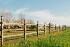
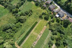
Larger parcels typically require more time and effort to measure and document. Terrain also plays a role. A flat residential lot is generally more straightforward than rural land with brush, fencing, or uneven ground.
Heavily wooded areas in the Rio Grande Valley, for example, may require additional effort to locate existing markers. Travel distance, accessibility, and site conditions can also influence the overall scope.
Survey Type and Project Complexity
The type of survey requested has a significant impact on the level of detail required. A boundary survey typically involves less detail than a topographic or ALTA/NSPS Land Title Survey.
Additional complexity can arise from missing markers, conflicting historical records, or unclear legal descriptions. Properties with a history of boundary disputes may require more extensive research and documentation.
Common Types of Surveys and When You Need Them
Selecting the appropriate survey type can help align the scope of work with your actual needs.
-
Boundary survey: Common for property transactions, fencing, or resolving boundary questions
-
Topographic survey: Maps elevation and site features for construction or development planning
-
ALTA/NSPS Land Title Survey: Often requested in commercial transactions or by lenders/title companies
-
As-built survey: Documents completed construction relative to plans
If you are unsure which type applies, that is common. Many homeowners benefit from a boundary survey. This guide to accurate property boundaries explains the basics, and you can explore additional services for more detail.
How to Approach Survey Needs Without Unnecessary Cost
Affordable does not mean minimal effort; it means aligning services with your actual needs.
Providing existing documents such as prior surveys, deeds, plats, and title documents can help reduce research time. Clearly explaining your purpose—whether for a fence, purchase, or development—helps determine the appropriate scope.
In some cases, combining related services into one project may improve efficiency. Many property owners also recognize that skipping a survey can lead to more complex issues later, as discussed in this overview.

Why Local South Texas Experience Matters
South Texas properties often involve unique characteristics, from historic parcels to large agricultural tracts. Familiarity with regional conditions can help surveyors navigate common challenges more efficiently.
Knowledge of Texas property laws, easements, and plat records is also important. Some issues may not be immediately visible in standard title searches.
Working with a local provider may also support more timely communication and follow-up. Southpoint Geodetics serves Harlingen, Brownsville, and surrounding Rio Grande Valley communities.
What to Expect During the Survey Process
Most surveys follow a structured process, though details vary by project.
-
Initial consultation: Discuss project goals and review available documents
-
Research: Examine recorded deeds, plats, and prior surveys
-
Fieldwork: Locate markers, measure boundaries, and collect site data using GPS and conventional methods
-
Deliverables: Provide a survey plat or report for use in transactions, permitting, or planning
Surveyors may also be available to explain findings or answer questions after delivery.
The Bottom Line on Affordable Land Survey Services in South Texas
A land survey plays an important role in understanding property boundaries and supporting real estate decisions. Southpoint Geodetics, LLC provides land survey services in South Texas with attention to professional standards, licensing requirements, and project-specific needs.
Whether you are purchasing property, planning construction, or reviewing boundary lines, selecting the appropriate survey type can help you move forward with clearer information.
To learn more or request a quote, visit Southpoint Geodetics.

What factors affect the scope of a land survey in South Texas?
Survey scope typically depends on property size, terrain, location, and survey type. Larger parcels, heavily wooded areas, and difficult terrain may require more time and resources, and missing corner markers or boundary disputes can increase the complexity of the work. Being clear about your purpose helps a surveyor recommend options that are appropriate for your situation.
Which type of survey is best for buying or selling property?
A boundary survey is often a suitable choice for many residential property transactions because it focuses on property lines and corner markers. In some cases, lenders or title companies may request additional detail through an ALTA/NSPS Land Title Survey. Your surveyor can discuss requirements for your specific transaction and suggest the type of survey that fits.
How can I get the most from affordable land survey services without losing accuracy?
You can support an efficient process by gathering existing documents—old surveys, deeds, and plats—before requesting a quote. Clearly explaining the purpose of the survey, grouping related work when it makes sense, and selecting a licensed local surveyor all help align the work with your needs. In many cases, foregoing a survey can lead to more complicated issues later, especially where boundaries or improvements are in question.
Why does hiring a local South Texas surveyor help?
Local surveyors are familiar with South Texas land characteristics, Texas easement laws, and regional plat practices, which can be important when interpreting records. Southpoint Geodetics serves Harlingen, Brownsville, and Rio Grande Valley communities, which can support timely scheduling and follow-up communication.
What is included in the land survey process?
The process generally starts with a consultation to understand your goals and review available documents. Surveyors then research recorded deeds and prior surveys, perform fieldwork to locate corners and measure boundaries, and prepare documentation such as a plat or report. This documentation can be used in closing, permitting, construction planning, or property decisions, depending on your needs.
What additional survey services does Southpoint offer beyond boundary surveys?
Southpoint Geodetics provides topographic surveys for construction planning, engineering-related surveys for civil projects, ALTA/NSPS surveys for commercial transactions, as-built surveys for completed construction, easement surveys, and farm and ranch surveys