
South Texas is transforming fast. New subdivisions are pushing outward from Brownsville, commercial development is accelerating along the 77/83 corridor, and land values across Cameron County continue to climb. When property is being carved up, rezoned, and sold at this pace, old boundary lines get blurry — and the cost of guessing wrong goes up.
A missing or outdated land survey can stall a home closing, spark a neighbor dispute, or derail construction permits anywhere in the Rio Grande Valley. Yet most property owners only think about hiring a surveyor after a problem surfaces. By then, timelines are tight, stress is high, and the stakes feel even bigger.
At Southpoint Geodetics, LLC, we believe requesting a land survey should be simple and stress-free — whether it’s your first home purchase in one of Brownsville’s newest neighborhoods, a boundary question on a family ranch, or a commercial project breaking ground along the corridor. This guide maps out every step of the process so you know exactly what to expect, what to prepare, and how to move forward with confidence from your first call to your final report.
When You Need A Land Survey
Not every property situation calls for a survey, but more do than most people realize. Here are the most common scenarios where a land survey becomes necessary:
- Buying or selling property. Mortgage lenders and title companies in South Texas frequently require a mortgage survey or an ALTA/NSPS land title survey before they’ll finalize a transaction. This confirms boundaries, identifies improvements, and flags potential encroachments.
- Building or renovating. Local municipalities often require a boundary or topographic survey before issuing construction permits. If you’re pouring a foundation or adding a structure, a survey ensures you’re building in the right location and at the correct elevation.
- Resolving a boundary dispute. Fence lines shift, neighbors disagree, and old markers disappear. A professional boundary survey establishes exactly where your property begins and ends.
- Subdividing land. Splitting a parcel for sale or development requires precise legal descriptions and plat preparation.
- Refinancing. Some lenders request an updated survey as part of the refinancing process, especially if the last one is several years old.
If you’re unsure whether your situation requires a survey, you can browse our blog for related topics that cover specific survey types in more detail.
What To Prepare Before Requesting A Survey
A little preparation on your end goes a long way toward getting an accurate quote and a faster turnaround. Before you reach out to a surveyor, try to gather the following:
- Your property’s legal description. This is typically found on your deed, title commitment, or closing documents. It gives the surveyor the official description of your parcel.
- A copy of your most recent survey (if one exists). Even an older survey can help the team understand past boundary markers, easements, and improvements.
- The purpose of the survey. Knowing whether you need a mortgage survey, a boundary survey, an ALTA/NSPS survey, or something else helps the surveyor scope the project correctly from the start.
- Any relevant deadlines. If your closing date is in two weeks or your builder needs to break ground by a certain date, communicate that upfront.
- Contact information for your real estate agent, lender, or title company. In many cases, the surveyor will need to coordinate directly with other parties involved in the transaction.
You don’t need to have every document perfectly organized. But the more context you can provide, the smoother the process will be. Property owners across the Rio Grande Valley often tell us that having their paperwork ready saved them days of back and forth.
How To Choose The Right Land Surveyor

Not all surveyors are the same, and choosing the right one matters more than most people expect. Here’s what to look for:
Licensing and credentials. In Texas, land surveyors must be Registered Professional Land Surveyors (RPLS). This isn’t optional. Always confirm that the surveyor you’re considering holds a valid state license.
Local experience. South Texas has its own set of challenges when it comes to land surveying. From old Spanish land grants in Cameron and Hidalgo Counties to flood zone considerations along the Rio Grande, a surveyor who knows the region will catch things an out-of-area firm might miss. At Southpoint Geodetics, LLC, we’re based in Harlingen and serve communities throughout South Texas, so we understand the terrain and the local requirements firsthand.
Range of services. Some firms only handle basic boundary surveys. Others offer the full spectrum, including ALTA/NSPS surveys, topographic surveys, engineering surveys, as-built surveys, and more. If your needs are likely to evolve, working with a firm that can handle multiple survey types saves time. You can explore the full range of services we offer to see what’s available.
Responsiveness. Delays in getting a survey can hold up an entire real estate closing or construction schedule. Ask about typical turnaround times and how quickly the firm responds to initial inquiries.
Equipment and methods. Modern surveying relies on a combination of GPS technology and traditional techniques. Firms that invest in current equipment tend to deliver more accurate and efficient results.
What To Expect After You Submit Your Request
Once you’ve reached out and provided your information, the process typically unfolds like this:
- Initial review and quote. The surveyor reviews your documents, confirms the type of survey needed, and provides a cost estimate. For straightforward mortgage surveys, this can happen within a day or two. More complex projects like ALTA/NSPS surveys may require additional coordination.
- Scheduling fieldwork. After you approve the quote, the survey crew schedules a visit to your property. Depending on the firm’s workload and your timeline, this might happen within a few days or a couple of weeks.
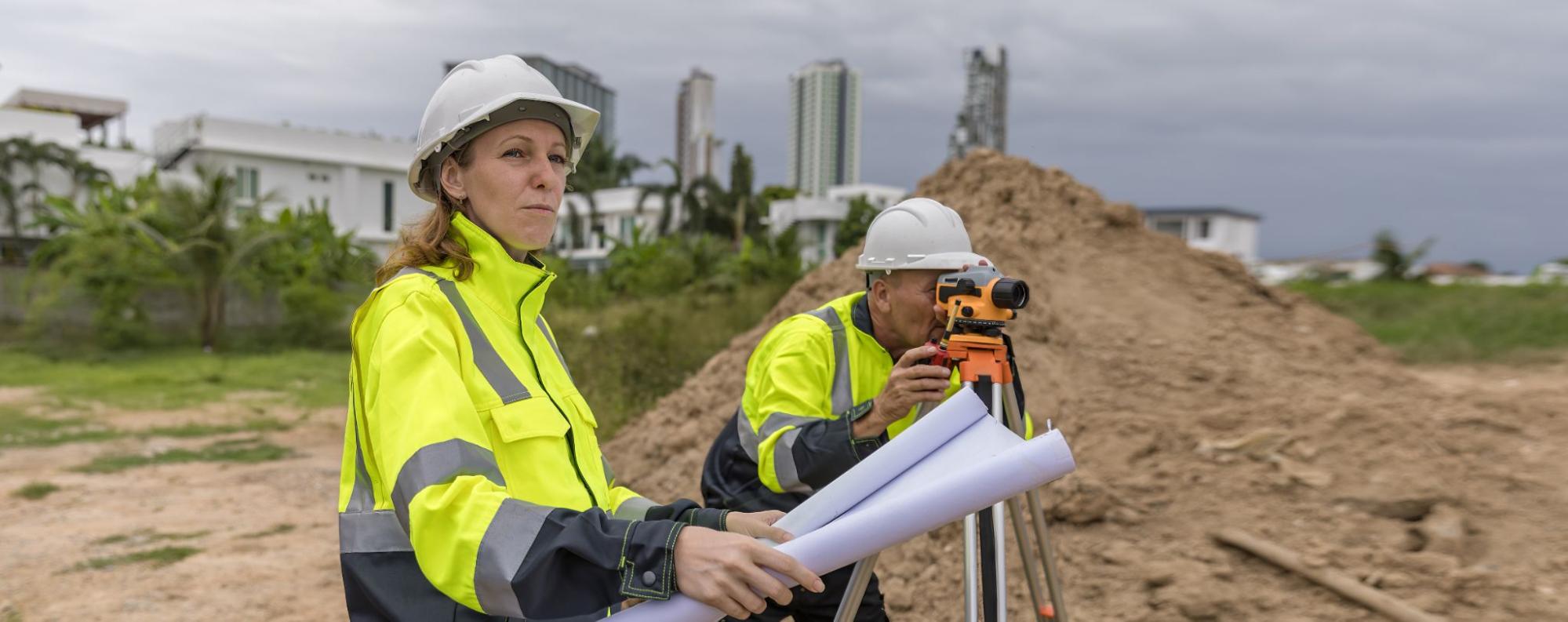
- On-site survey. The crew visits the property to take measurements, locate markers, identify improvements, and document features. You don’t necessarily need to be present, but it helps if someone can provide access to gated areas or point out known markers.
- Processing and drafting. Back in the office, the data is processed and the survey plat or map is drafted. This is where accuracy really matters, and experienced firms take the time to cross-reference findings with county records and legal descriptions.
- Delivery of the final survey. You receive the completed survey document, which can then be shared with your lender, title company, builder, or attorney as needed.
The entire process, from request to delivery, often takes one to three weeks for standard surveys. More complex projects may take longer, but a good surveyor will keep you informed throughout.
Common Mistakes To Avoid When Requesting A Survey

We’ve seen a few recurring missteps that can slow things down or lead to frustration. Here’s what to watch out for:
Waiting until the last minute. This is the most common issue. Property owners assume a survey can be completed in a day or two, then find themselves scrambling when their closing date is a week away. Give yourself a comfortable buffer.
Not specifying the type of survey you need. Telling a surveyor “I need a survey” without context is like telling a mechanic “my car needs fixing” without describing the problem. If your lender requires an ALTA/NSPS survey but you request a basic boundary survey, you’ll end up paying twice.
Choosing based on price alone. The cheapest survey isn’t always the best value. An inaccurate survey can lead to boundary disputes, construction errors, or title issues that cost far more to resolve later. Prioritize quality and credentials.
Forgetting to share access details. If your property is gated, landlocked, or difficult to reach, let the surveyor know in advance. Crews that arrive on-site and can’t access the property lose valuable time.
Ignoring the results. Once you receive your survey, take the time to review it. Ask questions about anything you don’t understand. The survey is a legal document, and knowing what it says protects your investment.
Conclusion

Knowing how to request land surveying services doesn’t require any special expertise. It just takes a little preparation, the right questions, and a qualified professional to guide the process. Whether you’re closing on a home in Brownsville, subdividing acreage near Harlingen, or preparing for a new construction project, starting with a clear understanding of what you need makes everything go more smoothly.
At Southpoint Geodetics, LLC, we’re here to help property owners across South Texas navigate these steps with confidence. If you’re ready to move forward, contact us to discuss your property and we’ll help determine the right survey for your situation.
How Do You Get a Survey of Your Land?
Start by gathering your property’s legal description, any existing survey documents, and details about why you need the survey. Then contact a licensed Registered Professional Land Surveyor (RPLS) in your area. The surveyor will review your documents, provide a cost estimate, and schedule fieldwork at your property. From request to delivery, the process typically takes one to three weeks for standard surveys. At Southpoint Geodetics, LLC, we make it simple to get started.
How Much Does It Cost for a Full Survey?
The cost of a full land survey depends on several factors, including the property’s size, location, terrain, and the type of survey required. Basic boundary or mortgage surveys are generally less expensive, while comprehensive ALTA/NSPS surveys cost more due to additional research and detail. To get an accurate quote, contact a licensed surveyor with your property’s legal description and project details. We provide transparent estimates after reviewing your specific needs.
How to Get a Property Line Survey for Free?
Truly free professional property line surveys are rare, as licensed surveyors invest significant time and equipment into accurate results. However, you can start by reviewing your existing deed, past survey documents, or county records for boundary information. Some title companies may include survey costs in closing transactions. For a legally binding and accurate boundary determination, hiring a licensed professional land surveyor is always the recommended approach to protect your investment.
What Documents Should I Prepare Before Requesting a Land Survey?
Before requesting a land survey, try to collect your property’s legal description from your deed or title commitment, any previous survey reports, your project deadline, and contact details for your real estate agent or lender. Providing this information upfront helps the surveyor deliver an accurate quote and faster turnaround.
What Types of Land Surveys Does Southpoint Geodetics, LLC Offer?
Southpoint Geodetics, LLC offers a comprehensive range of services, including boundary surveys, ALTA/NSPS land title surveys, mortgage surveys, topographic surveys, engineering surveys, as-built surveys, foundation surveys, and farm and ranch surveys. Whether your project is a single lot or thousands of acres, their experienced team can help.
How Long Does It Take to Complete a Land Survey?
Standard surveys such as mortgage or boundary surveys typically take one to three weeks from request to delivery. More complex projects like ALTA/NSPS surveys may require additional time for coordination with title companies and lenders. Communicating your deadlines early helps the surveyor prioritize your project accordingly.
Why Should I Hire a Licensed Professional Land Surveyor in Texas?
In Texas, land surveyors must hold a Registered Professional Land Surveyor (RPLS) license. Hiring a licensed professional ensures your survey meets legal standards and is accepted by lenders, title companies, and local municipalities. An accurate, professionally prepared survey also protects you from costly boundary disputes and construction errors.
What Is the Difference Between a Boundary Survey and an ALTA/NSPS Survey?
A boundary survey establishes the precise boundaries of a parcel using its legal description and sets or restores corner markers. An ALTA/NSPS survey is more comprehensive—it incorporates boundary, mortgage, and topographic survey elements to map all existing improvements, easements, and encroachments, and is typically required for commercial transactions and title insurance.