
Land boundary disputes can cost South Texas property owners thousands of dollars and years of legal headaches. A fence built two feet over the property line, a title issue discovered at closing, or a construction project halted by setback violations—these are problems we see regularly in Willacy County and throughout the Raymondville area.
The solution? Professional land surveying services that establish exactly where your property begins and ends. At Southpoint Geodetics, LLC, we help homeowners, developers, and real estate professionals avoid these costly surprises by providing precise, legally defensible survey documentation. In this guide, we’ll explain the different types of surveys available, when you need one, and what to expect from the process.
Buying rural acreage, subdividing land for development, or settling a boundary disagreement with a neighbor all have one thing in common: you need to understand your property’s exact dimensions. South Texas has unique surveying challenges, from Spanish land grants with complex title histories to rapidly developing areas where old fence lines no longer match legal boundaries. We’ll walk you through everything you need to know about land surveying services in Raymondville, TX, so you can make informed decisions and protect your investment.
Why Land Surveys Are Essential for Raymondville Property Transactions
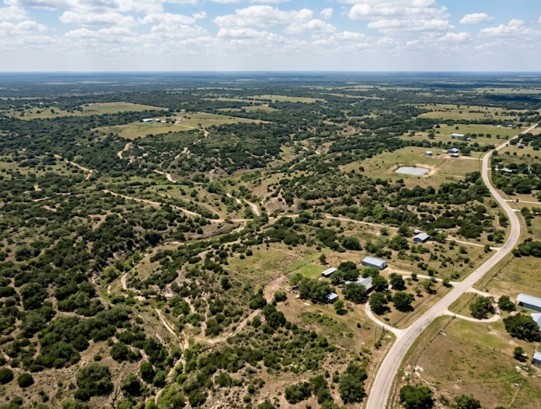
Raymondville sits in the heart of Willacy County, where agricultural tracts, residential lots, and newer developments all share the landscape. Property lines aren’t always obvious out here. Fences shift over time, old markers get lost, and verbal agreements between neighbors don’t always hold up when it’s time to close a sale.
A professional land survey establishes exactly where your property begins and ends, documented with precise measurements and legal descriptions. That clarity protects both buyer and seller. It also prevents disputes that can stall closings or lead to expensive legal battles down the road.

For mortgage lenders and title companies, a current survey is often a requirement before they’ll move forward with financing. Without one, you could find yourself stuck in limbo, waiting on paperwork while your closing date slips further away. And in a market where timing matters, that delay can cost real money.
Beyond transactions, accurate surveys protect your long term investment. Knowing the exact footprint of your property means you can plan improvements, avoid encroachments, and maintain good relationships with adjacent landowners.
Types of Land Surveying Services Available in Raymondville
Not every property situation calls for the same type of survey. Here’s a look at the most common land surveying services we provide:
- Boundary Surveys establish the legal boundaries of a parcel using the property’s recorded legal description. This is the most frequently requested survey and is essential for resolving fence line questions, preparing for construction, or settling disputes.
- Mortgage Surveys confirm property boundaries and map all improvements on a parcel. Lenders and title companies typically require these before approving financing on a purchase.
- Topographic Surveys map the physical features of your land, including elevation changes, drainage patterns, structures, and vegetation. Engineers and architects rely on these when planning new development or evaluating drainage and runoff.
- ALTA/NSPS Land Title Surveys meet the joint standards set by the American Land Title Association and the National Society of Professional Surveyors. These comprehensive surveys combine elements of boundary, mortgage, and topographic surveys and are often required for commercial transactions.
- Farm and Ranch Surveys are tailored for larger agricultural properties common throughout Willacy County and the surrounding area. Whether you’re buying, selling, or subdividing rural land, these surveys provide the detailed measurements needed for an accurate appraisal.
- As-Built Surveys document recently constructed elements on a property, verifying that structures were built according to plan and in the correct location.
To explore the full range of services we offer, including engineering surveys, foundation surveys, and utility mapping, visit our services page.
When You Need a Land Survey in Raymondville, TX
There are several situations where getting a land survey isn’t just helpful, it’s necessary.
Buying or selling property. Most real estate transactions in Texas require some form of survey. Your mortgage broker, title company, or real estate agent will let you know which type is needed, but having a current survey on file can speed up the closing process considerably.
Building or renovating. Before you pour a foundation or add an addition, you need to confirm that the construction falls within your property lines and meets local setback requirements. A survey prevents the nightmare scenario of building on land you don’t own.
Resolving boundary disputes. If you and a neighbor disagree about where one property ends and the other begins, a licensed surveyor’s findings carry legal weight and can resolve the issue without litigation.
Subdividing land. Splitting a larger parcel into smaller lots for sale or development requires precise measurements and legal descriptions for each new parcel.
Securing insurance or permits. Certain insurance policies and building permits require up to date survey data, especially in areas with flood zone considerations.
If you’re unsure whether your situation calls for a survey, you can browse our blog for related topics that cover specific scenarios in more detail.
What To Expect During the Surveying Process
If you’ve never hired a land surveyor before, the process is more straightforward than you might expect.
It starts with an initial consultation. We’ll discuss the purpose of your survey, review any existing documents you have (deeds, plats, prior surveys), and determine which type of survey fits your needs. This step helps us provide an accurate quote and timeline.
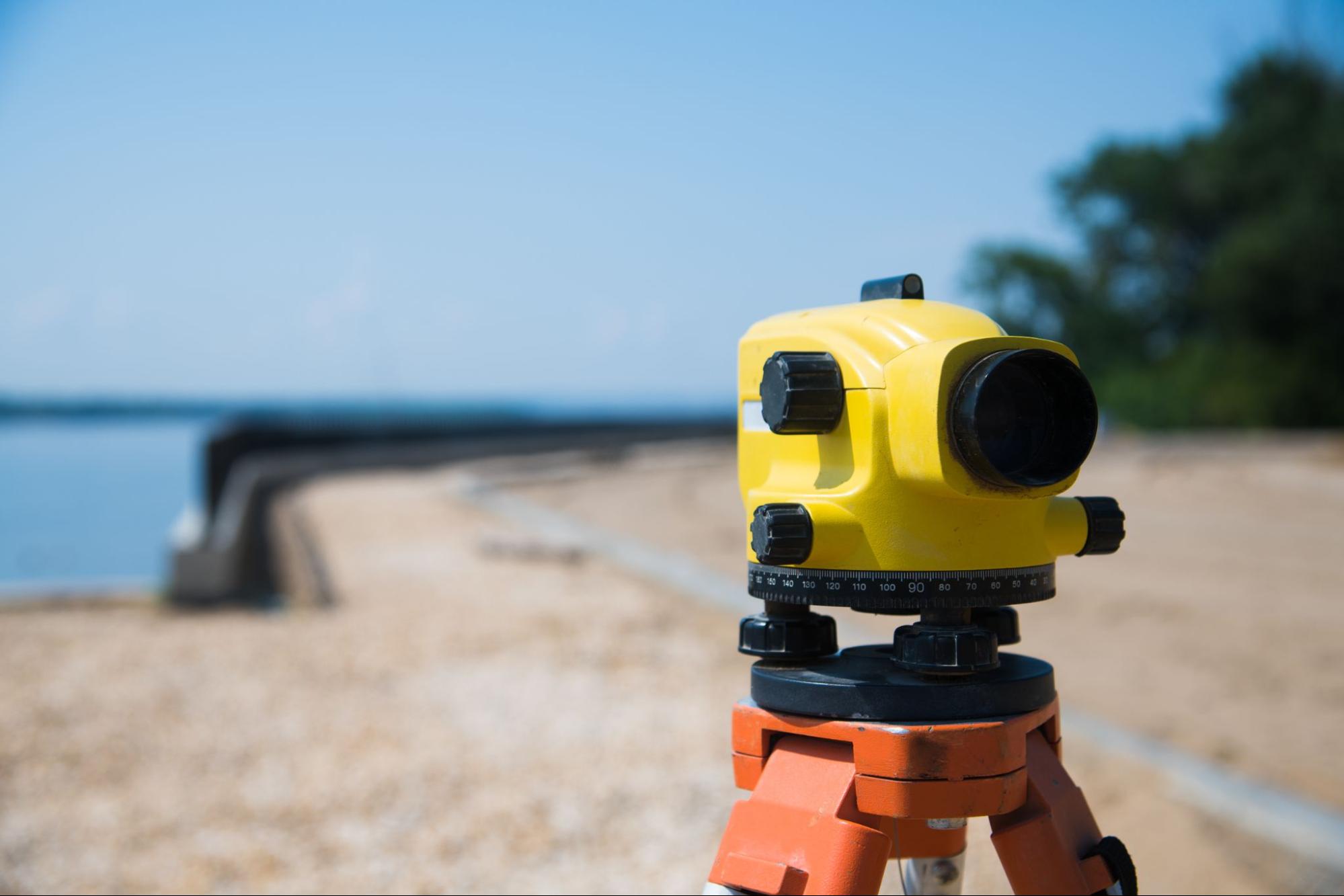
Next comes the fieldwork. A licensed surveyor and crew visit your property to take measurements using a combination of advanced GPS technology and traditional surveying techniques. Depending on the size and complexity of the parcel, fieldwork can take anywhere from a few hours to a couple of days.
After the field data is collected, it goes through processing and review. The surveyor prepares a detailed survey document that includes legal descriptions, boundary lines, easements, and the location of any improvements or physical features on the property.
Finally, you receive your completed survey. We walk you through the results so you understand exactly what’s documented and can share it with your lender, title company, builder, or attorney as needed.
Timelines vary based on the scope of work, but we prioritize quick response times because we understand that delays on your survey can hold up everything else.
How To Choose a Qualified Land Surveyor in South Texas
Choosing the right surveyor matters. An inaccurate survey can lead to boundary disputes, construction errors, and title complications that are far more expensive to fix after the fact.
Here are a few things to look for:
State licensure. In Texas, land surveyors must be Registered Professional Land Surveyors (RPLS). Always verify that your surveyor holds a current license with the Texas Board of Professional Land Surveying.
Local experience. South Texas has its own characteristics when it comes to land records, property descriptions, and terrain. A surveyor who knows Willacy County, the Rio Grande Valley, and the surrounding areas will be more efficient and more familiar with local requirements.
Modern equipment. Look for a firm that uses state of the art GPS systems alongside conventional surveying methods. This combination delivers the most accurate results.
Clear communication. Your surveyor should be able to explain findings in plain language, not just technical jargon. You deserve to understand what you’re paying for.
At Southpoint Geodetics, LLC, we were founded by Michael Wood, a Registered Professional Land Surveyor licensed in both Texas and Mississippi. Based in Harlingen, we serve the entire Rio Grande Valley and South Texas region. We work closely with realtors, mortgage brokers, engineers, and project managers to make sure your land records and plans are accurate and current.
Conclusion
A land survey is one of those steps that can feel like just another item on a long checklist, but it’s actually one of the most important decisions you’ll make during any property transaction. For Raymondville property owners, having accurate, professionally prepared survey documentation means fewer surprises, stronger legal footing, and a smoother path to closing.
Whether you’re preparing to buy, sell, build, or simply need clarity on your property boundaries, the right land surveying services can give you the confidence to move forward.
If you have questions or want to discuss your specific situation, reach out to our team today. We’re here to help you take the next step with clear information and dependable results.
How much do land surveying services cost in Raymondville, TX?
Land surveying costs in Raymondville, TX are affected by lot size, terrain complexity, survey type, property access, existing documentation, and rush requests. Contact local surveyors for accurate quotes tailored to your specific property needs.
What types of land surveys are available in Raymondville?
Raymondville surveyors offer boundary surveys, topographic surveys, ALTA/NSPS surveys, construction surveys, and subdivision surveys. Boundary surveys define property lines, while topographic surveys map elevation changes. ALTA surveys meet lender requirements for commercial transactions. Construction surveys ensure accurate building placement. Each survey type serves different purposes for homeowners, developers, and businesses throughout Willacy County.
Do I need a land survey before buying property in Raymondville?
Yes, obtaining a land survey before purchasing property in Raymondville is highly recommended. Surveys reveal exact boundary lines, easements, encroachments, and potential title issues. Lenders often require surveys for mortgage approval. Investing in a survey protects your investment, prevents future disputes with neighbors, and ensures you understand exactly what you’re purchasing.
What should I look for in a Raymondville land surveyor?
Choose a licensed Texas Professional Land Surveyor (RPLS) with local Raymondville and Willacy County experience. Verify their credentials, insurance coverage, and references. Look for surveyors familiar with local terrain, regulations, and county records. Ask about turnaround times, pricing transparency, and included deliverables. Experienced local surveyors provide more accurate results and smoother processes.
Are land survey results legally binding in Texas?
Yes, surveys conducted by licensed Texas Registered Professional Land Surveyors are legally recognized documents. They can be used in court proceedings, property disputes, and real estate transactions. Survey plats become part of official county records when filed. However, surveys represent professional opinions based on available evidence and may be challenged by other licensed surveyors.
How often should I get my Raymondville property surveyed?
New surveys are recommended when buying or selling property, before construction projects, during boundary disputes, or when subdividing land. Properties don’t require regular resurveying unless changes occur. However, if your last survey is over 10 years old or significant development happened nearby, an updated survey ensures accurate boundary information and protects your property rights.
Can land surveyors access my neighbor’s property in Raymondville?
Texas law grants licensed surveyors reasonable right of entry onto adjacent properties to conduct surveys. Surveyors typically notify neighbors as a courtesy. They cannot damage property or remove obstacles without permission. If access issues arise, professional surveyors work diplomatically to complete their work while respecting property rights of all parties involved.
Can I do a land survey myself?
While you can measure your property using online tools or metal detectors to find markers, a DIY survey isn’t legally recognized. Only licensed surveyors can produce official documents accepted by courts, title companies, and local governments. Self-surveys may help with general planning, but for legal matters like boundary disputes, construction permits, or property sales, you’ll need a professional survey from a trusted provider like Southpoint Geodetics, LLC, LLC.
What is the difference between a survey and a boundary survey?
A land survey is an umbrella term that encompasses many types of assessments, including topographic, ALTA, improvement, and boundary surveys. A boundary survey is one specific type focused on identifying the exact legal boundaries of a property. It locates property corners, measures distances, and creates an official document showing precise property lines. Boundary surveys are typically required for resolving disputes, building fences, or transferring property ownership.
What are red flags on a survey?
Key red flags include encroachments where structures cross property lines, easements that limit land use, discrepancies between the deed description and actual boundaries, and missing or moved boundary markers. Other concerns are overlapping claims with neighbors, setback violations, and properties located in flood zones. These issues can affect property value, legal ownership, and your ability to build or modify structures.
What is the most accurate way to find property lines?
Hiring a licensed land surveyor is the most accurate method. Surveyors use professional-grade GPS equipment, historical records, and legal documents to establish precise boundaries. They locate or set official markers and provide legally binding documentation. While deed descriptions and county records offer helpful information, only a professional survey from an experienced team like Southpoint Geodetics, LLC, LLC provides the accuracy needed for legal and construction purposes.