Choosing a land surveying company can affect more than where a property line is drawn. Survey information may influence a real estate closing, construction plan, subdivision, or future use of the property.
When comparing a top-rated land surveying company in South Texas, look beyond price. Credentials, local experience, survey scope, communication, cost, and expected timing all matter.
Southpoint Geodetics, LLC is based in Harlingen and serves clients throughout the Rio Grande Valley and South Texas. The right survey starts with understanding the property, why the information is needed, and what the finished survey must show.
What Makes a Top-Rated Land Surveying Company Different?

A land survey often begins before anyone reaches the property.
Depending on the assignment, the surveyor may review deeds, recorded plats, easements, title documents, previous surveys, and other available property records. That research helps guide fieldwork and identify conflicts that need closer review.
A dependable surveying company should also explain what the survey includes, which documents the client should provide, and what deliverables to expect.
If an issue appears during research or fieldwork, the client should understand what was found and whether it affects the scope or schedule.
Check Professional Credentials
Texas regulates professional land surveying through the Texas Board of Professional Engineers and Land Surveyors. Firms that offer land surveying services to the public in Texas must register with the Board and employ a full-time Registered Professional Land Surveyor. Clients can verify individual and firm registration through the Texas Board of Professional Engineers and Land Surveyors.
Registration is only one part of the comparison. Ask about experience with the type of property and survey you need, as well as documentation practices, field technology, and quality-control procedures.
Consider South Texas Experience
Local experience can be especially useful when surveying property in Harlingen, Cameron County, and the Rio Grande Valley.
A platted residential lot may present different research and field conditions from rural acreage, agricultural property, or a commercial development site. Older plats, drainage features, irrigation infrastructure, utility easements, and local development patterns may all affect the work.
A surveyor familiar with these conditions may be better prepared to identify records or site features that deserve additional review.
Land Surveying Services for Property Owners and Real Estate Professionals
The right survey depends on what you plan to do with the property.
A homebuyer may need boundary and improvement information before closing. A builder may need elevations or construction layout. A commercial buyer may need detailed information about boundaries, easements, access, utilities, and visible improvements.
Before requesting a quote, gather any deeds, title commitments, plats, plans, or previous survey documents you already have.
If you are unsure which service fits your project, explore Southpoint Geodetics’ land surveying services before requesting a quote.
Boundary, Title, and Improvement Surveys

A boundary survey identifies the limits of a parcel using the legal description, available records, monuments, field evidence, and applicable professional standards.
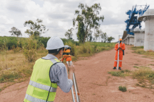
Fieldwork may include locating existing monuments, examining occupation lines such as fences, and setting or restoring property corners when appropriate.
A fence can be relevant evidence, but it is not automatically the legal property boundary.
An improvement survey documents visible improvements in relation to the property boundaries. Depending on the agreed scope, this may include buildings, driveways, fences, sidewalks, and apparent encroachments.
Having that information before a transaction is finalized can help buyers, sellers, lenders, and other parties better understand existing property conditions.
ALTA/NSPS Land Title Surveys
An ALTA/NSPS Land Title Survey follows nationally recognized standards developed by the American Land Title Association and National Society of Professional Surveyors.
The current 2026 ALTA/NSPS Minimum Standard Detail Requirements became effective February 23, 2026. They establish minimum survey requirements and include items that may be requested for a particular transaction.
These surveys are commonly associated with commercial and other real estate transactions where title, lender, client, and survey requirements need to be coordinated. Because different parties may require different information, the scope and items should be confirmed before fieldwork begins.
Construction, Subdivision, and Development Surveys

Surveying can continue throughout a construction or development project rather than ending with one site visit.
A topographic survey records existing features such as terrain, elevations, drainage conditions, structures, and other visible site improvements. Engineers and designers may use that information when preparing plans.
Construction staking transfers approved design information from plans to physical locations on the site. Clear coordination between the surveyor, engineer, contractor, and owner can help reduce misunderstandings as the project moves from design to construction.
Plan for Subdivision Requirements Early
Subdivision projects may require boundary work, plat preparation, easement research, engineering coordination, and review by a city, county, or other applicable authority. Requirements can differ by jurisdiction, so the necessary survey documents and approvals should be identified early in the process.
This is particularly useful when plans are still flexible. Discovering a boundary, easement, drainage, or access issue before construction starts can give the project team more room to evaluate the next step.
For more guidance before starting a project, read Southpoint’s South Texas land surveying resources for additional information about surveys, property planning, and project preparation.
How to Compare Land Surveying Companies in South Texas

Credentials are important, but they should not be the only deciding factor. A company that mainly works on subdivision lots may have different experience from one that regularly handles rural acreage, commercial title surveys, construction projects, or complex development work.
Compare Experience With Similar Properties
Ask whether the surveying company has worked on properties similar to yours.
For South Texas projects, experience with municipal processes, historic plats, drainage systems, irrigation features, agricultural land, and local development patterns can provide useful context during research and fieldwork.
Southpoint Geodetics works with property owners and project teams throughout Harlingen, the Rio Grande Valley, and South Texas.
Compare Quotes by Scope, Not Price Alone
The lowest quote is not always based on the same scope of work. Property size matters, but access, vegetation, terrain, missing monuments, travel, research complexity, record quality, and required deliverables may also affect pricing. Ask what the proposal includes. Research, fieldwork, property corner work, coordination, and final deliverables may differ from one quote to another.
If you are preparing to request pricing, review Southpoint’s land surveying guidance and project resources before submitting your project information.
Ask About Timing
Turnaround time depends on more than the size of the property. Records research, site access, weather, field conditions, conflicting evidence, and additional research may affect the schedule.
Ask when research and fieldwork are expected to begin and what conditions could change the estimated completion date. A realistic timeline based on the property and requested scope is generally more useful than a quick estimate given before the project has been reviewed.
Questions to Ask Before Hiring a Land Surveying Company
Before hiring a surveyor, ask enough questions to understand exactly what you are ordering.
Consider asking:
- Is a Texas Registered Professional Land Surveyor responsible for the work?
- Is the surveying firm currently registered in Texas?
- Which type of survey fits the intended use of the property?
- What documents should I provide before work begins?
- Does the quote include research, fieldwork, corner marking, and a signed survey document?
- Will a title commitment or easement documents be needed?
- If an ALTA/NSPS survey is required, which Table A items should be requested?
- How will access to fenced, occupied, or rural property be handled?
- What could affect the quoted fee?
- What could affect the estimated completion date?
- How will conflicting evidence or apparent encroachments be communicated?
- Will coordination with a title company, engineer, architect, attorney, or public agency be required?
It is also worth asking what the survey does not determine. Surveyors evaluate and document record and physical evidence within the professional scope of the assignment. They do not resolve legal ownership disputes or provide legal opinions.
When competing ownership claims or legal interpretations are involved, an attorney may need to address those issues separately.
Conclusion

Choosing a top-rated land surveying company in South Texas involves more than comparing fees or promised turnaround times. Confirm professional credentials, look for experience with similar properties, understand exactly what the quote includes, and make sure the surveyor knows how the finished survey will be used.
Local experience can also matter when a property involves older records, easements, drainage systems, irrigation infrastructure, subdivision requirements, or other conditions found throughout the Rio Grande Valley.
Before requesting a survey, gather any deeds, title documents, plats, project plans, or previous surveys you already have. Providing that information can help the surveying company define the appropriate scope.
If you are planning a property transaction, construction project, subdivision, or development in South Texas, contact Southpoint Geodetics to discuss your property and request a survey quote.
What Makes A Top Rated Land Surveying Company Different From Others?
A top rated land surveying company combines careful record research, accurate fieldwork, appropriate professional oversight, clear communication, and relevant local knowledge. It should also explain the survey’s scope, deliverables, limitations, cost, and expected timing before work begins.
Why Is It Important To Hire A Texas Registered Professional Land Surveyor?
Professional surveying services in Texas must be performed under the authority of a Registered Professional Land Surveyor when required. Confirming registration verifies that the responsible professional has met state requirements and can supervise and seal the applicable surveying work.
What Types Of Land Surveying Services Are Commonly Offered By Top Surveyors?
Common services include boundary surveys, ALTA/NSPS Land Title Surveys, improvement surveys, topographic surveys, construction staking, and subdivision-related surveying. The appropriate service depends on the property, the intended use, and the requirements of other involved parties.
How Should I Compare Land Surveying Companies In South Texas?
Compare professional credentials, experience with similar properties, familiarity with South Texas records and conditions, the detailed scope of work, pricing, and realistic timing. Confirm what the quote includes and how the company will communicate record conflicts, access issues, or changes to the anticipated schedule.
What Is An ALTA/NSPS Land Title Survey And When Is It Needed?
An ALTA/NSPS Land Title Survey follows nationally recognized standards and is commonly used for commercial or complex property transactions. Its scope should be coordinated among the surveyor, client, title company, lender, and other involved parties before fieldwork begins.
How Do Land Surveys Benefit Property Buyers And Developers?
Land surveys clarify boundaries, identify recorded or visible property conditions, document improvements, and provide topographic or construction-related information. This information lets buyers, developers, designers, and builders make better-informed decisions before closing or beginning work.