
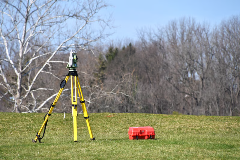
A topographic survey estimate is more than a price for fieldwork. It reflects the property, the purpose of the survey, the amount of detail required, and the final files needed by an engineer, architect, builder, or property owner. Because every property and project is different, an estimate is usually based on site conditions, required detail, field time, and deliverables rather than a single standard price.
When these details are clear from the beginning, budgeting becomes easier and unexpected changes are less likely. At Southpoint Geodetics, LLC, we help clients throughout the Rio Grande Valley and South Texas understand what goes into an estimate so they can plan confidently before buying, designing, developing, or building on a property. Explore Southpoint’s surveying services to see the options available for different property and project needs.
What A Topographic Survey Estimate Typically Includes
A topographic survey documents the locations and elevations of natural and constructed features on a property. Depending on the project, it may show contours, buildings, pavement, sidewalks, fences, drainage features, visible utility structures, trees, retaining walls, and other improvements. The U.S. Geological Survey explains how contour lines represent the shape and elevation of the land.
A typical topographic survey estimate may include:
- Reviewing available deeds, plats, plans, and project information
- Planning fieldwork and establishing survey control
- Collecting measurements with appropriate surveying equipment
- Processing and checking field data
- Preparing contours, spot elevations, and mapped features
- Completing quality-control checks
- Delivering the agreed survey drawings and digital files
Not every topographic survey includes boundary determination, underground utility investigation, or extensive record research. These services may require additional work and fees, so the estimate should clearly state what is included and excluded.
Clients can learn more about our survey services when deciding which survey products may be suitable for their property or project.
What A Topographic Survey Estimate Typically Includes

There is no single price that applies to every property. Two parcels with the same acreage can require very different amounts of work. An open, regularly shaped tract may be relatively straightforward to survey, while a smaller property with dense vegetation, drainage structures, heavy traffic, fences, buildings, or other improvements may take much longer.
The purpose of the survey also affects the estimate. A survey used for an early site evaluation may require less detail than one prepared for engineering design. Before preparing an estimate, the surveyor needs to understand the site, the project purpose, and what the final survey must provide.
Property Size, Location, Terrain, And Accessibility

Acreage affects pricing, but it is only one part of the calculation. Parcel shape, site features, and how easily crews can move across the property also influence the amount of fieldwork required.
Long, narrow, or irregularly shaped properties may require additional survey setups even when the acreage is modest. Thick brush, standing water, steep slopes, cultivated land, and limited vehicle access can also slow data collection.
South Texas properties may include irrigation infrastructure, resacas, drainage ditches, and lowlying ground. These features may require closer measurement when documenting elevations and drainage conditions. Urban sites can bring different challenges, including traffic, limited parking, secured areas, or coordination with occupants. If crews cannot reach part of the site, the project may take longer and cost more.
Project Scope, Required Detail, And Deliverables

The level of detail requested can significantly affect a topographic survey estimate. A basic survey showing terrain and major improvements usually requires less work than a detailed design survey that identifies individual trees, utility appurtenances, curb profiles, drainage structures, and frequent elevation points.
Contour intervals can also affect the scope. Closely spaced contours generally require denser field observations than broader intervals. The appropriate interval should be based on the terrain and intended use of the survey. USGS provides additional background on how contour spacing reflects terrain.
Final deliverables should be discussed early. An engineer may need an editable CAD file tied to a specific coordinate system and vertical datum. Other projects may require a signed survey drawing, digital terrain model, point data, or a combination of file types. Utility requirements should also be clear because mapping visible utility features is different from researching utility records or coordinating underground utility investigations.
Defining these requirements before work begins helps the estimate reflect the actual project and reduces the risk of additional costs later.
How To Request An Accurate Estimate And Avoid Delays
Providing clear information at the beginning makes it easier for a surveyor to prepare an accurate scope and estimate.
A street address is useful, but it may not always identify the exact survey area. A legal description, recorded plat, deed, tax parcel information, or marked aerial image can define the property more clearly. For larger sites, specify the limits of work if only part of the property needs to be surveyed.
When available, provide:
- The intended use of the survey
- Approximate property size and survey limits
- Available plats, deeds, plans, or previous survey documents
- Written requirements from the engineer or architect
- Requested features, contour interval, datum, and coordinate system
- Required file formats and target delivery date
- Known gates, animals, tenants, access restrictions, or hazardous conditions
Project timing should include more than the preferred field date. Research, access coordination, field measurements, data processing, drafting, and quality review all take time. Weather and saturated ground can also affect fieldwork in South Texas.
If you are unsure what information to gather, review Southpoint’s guide to requesting a land surveying quote before submitting your project details. Early communication between the property owner, surveyor, engineer, architect, and contractor can help prevent unnecessary changes later
How To Compare Survey Estimates Beyond Price
The lowest estimate is not always the best value. Two proposals with different prices may cover very different levels of work.
One surveyor may include detailed feature mapping, elevation information, and editable design files, while another may provide limited field data and a PDF drawing. A lower initial price can become more expensive if additional information has to be requested later.
When comparing estimates, look for:
- A clearly defined survey area and scope
- Features that will be mapped and any exclusions
- The proposed contour interval or elevation detail
- Boundary work, if separately requested
- The horizontal coordinate system and vertical datum
- Required file formats and deliverables
- Estimated schedule and access assumptions
- Terms for revisions or additional work
Professional qualifications also matter. In Texas, work that qualifies as professional land surveying must be performed under the authority of an appropriately licensed Registered Professional Land Surveyor. The Texas Board of Professional Engineers and Land Surveyors regulates professional surveying practice, while local requirements, project contracts, and site conditions may also affect the scope.
A useful topographic survey estimate should make responsibilities clear. It should explain what the surveyor will measure, what the client must provide, and whether any part of the project requires coordination with another professional. If two estimates appear very different, ask each surveying firm to explain its assumptions. Comparing the actual scope is more useful than comparing the final price alone.
Conclusion

A dependable topographic survey estimate should reflect the property, project purpose, required level of detail, and final deliverables. Price matters, but it is only useful when you understand what the estimate actually includes.
Providing complete property information and comparing survey scopes carefully can reduce uncertainty before fieldwork begins. It can also help engineers, builders, property owners, and other project professionals receive the information they need without avoidable revisions or added costs.
If you are planning a project in South Texas, contact Southpoint Geodetics, LLC to discuss your property, survey requirements, and project scope. A clear request gives the surveyor the information needed to prepare an estimate that matches the work your project actually requires.
Topographic survey estimate FAQs
What does a topographic survey estimate typically include?
A topographic survey estimate usually accounts for reviewing available property information, planning fieldwork, collecting measurements, processing survey data, preparing contours and mapped features, completing quality-control checks, and delivering the agreed survey drawings or digital files.
How do property size and terrain affect a topographic survey estimate?
Larger properties often require more field time, but acreage is not the only factor. Parcel shape, vegetation, slopes, standing water, drainage features, improvements, and accessibility can all affect the amount of work required.
Why should I specify deliverables when requesting an estimate?
Different projects require different outputs. Identifying whether you need CAD files, a signed drawing, point data, a digital terrain model, a specific contour interval, or particular coordinate information helps the surveyor estimate the correct scope from the beginning.
How can I request a more accurate topographic survey estimate?
Provide the property location, legal description or parcel information, intended survey use, limits of work, requested features, available plans or deeds, required file formats, and known access restrictions.
What factors determine the cost of a topographic survey?
Cost depends on property size and shape, terrain, vegetation, accessibility, site features, required detail, project purpose, deliverables, and the amount of field and office work needed.
Can a topographic survey include boundary or underground utility work?
These services should not automatically be assumed to be part of a topographic survey. Boundary determination and underground utility investigation may require separate scopes, coordination, and fees.