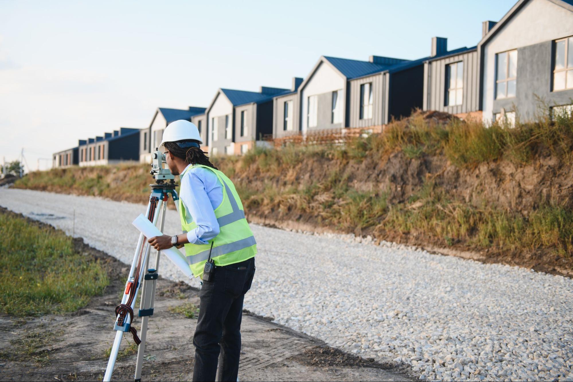
If you’ve ever stood in a backyard and wondered, “Is that fence actually on our side?” you already understand why a residential land surveyor matters. In South Texas, small misunderstandings about corners, easements, or past construction can turn into big delays during a sale or a costly change order during a build.
At Southpoint Texas Surveying, we spend a lot of time helping homeowners, buyers, agents, and builders replace guesswork with clear documentation. This guide breaks down what a residential land surveyor does, when you typically need a survey, what affects cost and timeline, and how to choose the right team for your property.
The Role Of A Residential Land Surveyor (In Plain English)
A residential land surveyor measures and documents what you own and how it relates to what’s around it. That includes the legal property boundary, the location of visible improvements, and any recorded rights that affect how the land can be used.
Most people are not looking for “more paperwork.” They’re looking for certainty. A survey gives you a defensible reference point that helps prevent disputes and keeps projects moving.
Boundary Lines, Corners, And Encroachments
Your deed describes the property, but it usually does not show you where the corners are on the ground. A survey ties your legal description to real-world evidence such as monuments, recorded plats, and measured distances.
A survey can also identify encroachments, which is a plain way of saying something crosses a boundary line. Common examples include:
- A fence built slightly over the line
- A driveway or sidewalk that extends into a neighboring lot
- A shed or addition that sits too close to the boundary
Catching these early is especially helpful before closing or before you pour concrete.
Improvements, Easements, And Other Items Shown On A Survey
Residential surveys often show improvements like the home footprint, garage, fences, patios, pools, and other structures. They may also show recorded items that affect use of the property.
The big one is easements. An easement is a legal right for someone else to use a portion of the property for a specific purpose, like utilities, drainage, or access. Easements do not always look obvious in the field, but they can matter a lot when you plan a fence line, pool, or addition.
Common Situations That Call For A Survey

In real life, most survey requests come from a deadline. A closing date. A permit. A contractor ready to start. The best time to think about surveying is before the schedule gets tight.
Buying Or Selling A Home (Closing And Lender Requirements)
A survey is often required for a real estate transaction because lenders and title companies want to reduce uncertainty about what they are financing and insuring.
Even when a lender does not strictly require a new survey, a buyer may still want one if there are signs of risk, including:
- Fences that do not line up with neighbors
- Additions, detached structures, or a new pool
- A corner lot, irregular lot shape, or older subdivision
- Prior boundary questions or unclear property markings
When everyone is working toward closing, an accurate survey helps keep surprises from showing up at the last minute.
Building, Adding A Fence, Pool, Or Other Improvements
Before you build, it helps to know exactly where the boundary is and what restrictions apply. Setbacks, easements, and drainage paths can change where improvements can go.
For example, a fence that seems “close enough” can become expensive if it lands in an easement or over the line. The same goes for concrete work. Once it’s in the ground, it’s not a small correction.
If you’re planning a project and want to understand which survey might fit, you can also learn more about our survey services through our overview page: explore the full range of services we offer.
Resolving Boundary Questions With Neighbors
Neighbor questions are common, and they’re not always hostile. Sometimes both parties simply want clarity. A survey provides a professional, documented basis for the conversation.
We also find that addressing boundary questions early reduces the chance that an assumption becomes “truth” over time. Clear corners and lines help everyone make decisions with more confidence.
Types Of Residential Surveys And When Each Applies
“I just need a survey” is a completely normal place to start. The next step is matching the survey type to your goal, because not every situation calls for the same scope.
New Survey Vs. Existing Survey Vs. Survey Update
In a transaction, you may hear these terms used interchangeably, but they can mean different things.
- New survey generally means new fieldwork and a current drawing based on today’s conditions and available records.
- Existing survey is a prior survey you already have. It can be useful, but it may not reflect current improvements or current title requirements.
- Survey update may refer to updating a prior survey or providing a revised drawing. Whether an update is appropriate depends on age, changes to the property, and what your lender or title company will accept.
If you have an older survey in a file drawer, it’s still worth sharing. It can help, even if it cannot be reused as-is.
Boundary Survey Vs. Improvement Survey Vs. Elevation-Related Work
You may also hear survey types described by what they emphasize:
- Boundary survey focuses on establishing property lines and corners based on record research and field evidence.
- Improvement survey (sometimes requested in residential transactions) maps visible improvements in relation to the boundary.
- Elevation-related work can come up in flood zones or drainage-sensitive areas, where elevations and benchmarks matter.
If you want more background reading on related survey topics, you can browse our blog for related topics and see how different surveys support buying, selling, and building.
Factors That Affect Survey Cost And Timeline In South Texas

Survey pricing and turnaround time are not one-size-fits-all. Two homes in the same neighborhood can still differ in complexity depending on records, access, and what has changed over time.
Records Research, Field Access, And Lot Complexity
A residential land surveyor spends time in two places: the records and the field.
On the research side, we may review plats, deeds, and other recorded documents to understand how the parcel was created and how it relates to neighboring tracts.
On the field side, timeline can be affected by:
- Access to the full property, including side yards, fenced areas, or locked gates
- Vegetation and visibility, especially along rear lines or drainage areas
- Lot geometry, like pie-shaped lots, irregular boundaries, or tracts that were split over time
- Monumentation, meaning whether corner markers are present, disturbed, or missing
Rush Requests, Weather, And Seasonal Demand
In South Texas, weather is not just a comfort issue. Rain, saturated ground, and heavy brush growth can slow down fieldwork.
Seasonal demand also matters. When the market is busy, closings stack up and schedules fill quickly. Rush requests can sometimes be accommodated, but they depend on current workload and the property’s complexity.
The most practical way to protect your timeline is to start the survey conversation early, especially if you have a firm closing or construction start date.
Choosing The Right Residential Land Surveyor
Choosing a residential land surveyor is not just checking a box. You’re selecting the professional record that others may rely on later, including title companies, lenders, and sometimes attorneys or neighbors.
At Southpoint Texas Surveying, we aim to be clear about scope, timing, and what you’ll receive, because the goal is fewer surprises and smoother decisions.
Questions To Ask Before You Hire
A few straightforward questions can help you compare options and avoid misalignment:
- What type of survey do you recommend for our situation, and why?
- What will the deliverable look like (sealed drawing, digital copy, stakes, flags)?
- What is your estimated timeline, and what could extend it?
- Will you show easements and improvements, or only boundary lines?
- If something unusual shows up, how will you communicate it?
What To Provide Up Front To Avoid Delays
You can often speed up the process by sharing what you already have:
- The property address and legal description (from the deed or listing)
- The title company or lender requirements, if this is for closing
- Any existing surveys, plats, or prior documentation
- Notes about access, gate codes, pets, and restricted areas
- A quick description of what you’re planning to do (fence, addition, pool, resale)
When we know the purpose up front, we can recommend the right scope instead of making assumptions that cost time later.
Reading Your Survey And Taking Next Steps
A survey can look intimidating at first, but you do not need to be a surveyor to get value from it. With a few reference points, you can understand what it says and what questions to ask.
What To Look For On The Plat Or Drawing
When you review your residential land survey, focus on these practical items:
- Property lines and corner calls: how the boundary is drawn and how corners are identified
- Dimensions: measured lengths along the boundary and ties to monuments
- Easements: utility, drainage, access, and any noted restrictions
- Improvements: the home footprint, fences, driveways, sheds, pools, and patios
- Notes and legends: explanations for symbols, abbreviations, and any limitations
If you are in a transaction, share the survey with your agent and title company early. That timing alone can prevent closing-day stress.
When To Call Back With Questions Or Request Staking
If something does not match what you expected, it is worth clarifying before you build or sign.
Common reasons to call back include:
- You need help interpreting an easement or setback note
- You want corners or lines marked for a fence contractor
- A neighbor raises a concern and you want to respond with documentation
- You are planning improvements and need clearer field marking
If you’re unsure what you’re looking at, we’d rather answer questions early than have you make a decision based on a misread symbol.
Conclusion

A residential land surveyor helps turn a property from “we think this is the line” into “we know where it is,” with documentation you can rely on for closing, planning, and building. In South Texas, that clarity protects property rights, reduces delays, and keeps neighbor and project conversations grounded in facts.
At Southpoint Texas Surveying, we’re here to make the process understandable and straightforward, whether you’re buying, selling, or improving a home or lot. If you’d like to talk through your situation and what survey makes sense, you can reach out to our team and we’ll help you take the next step with confidence.
What does a residential land surveyor do?
A residential land surveyor measures and documents your property boundaries and how they relate to nearby lots. The survey ties the deed description to real-world evidence (monuments, plats, measurements) and typically shows improvements and recorded items like easements—giving you clear, defensible documentation instead of guesswork.
When do I need a residential land surveyor for buying or selling a home?
Many closings involve lender or title company requirements, so a residential land surveyor is often needed before purchase or sale. Even if not required, a survey is smart when fences don’t align, there are additions or pools, the lot is irregular or older, or prior boundary questions could delay closing.
What issues can a residential land surveyor find (fences, encroachments, easements)?
A residential land surveyor can identify encroachments—like a fence, driveway, sidewalk, shed, or addition crossing a boundary or sitting too close to it. Surveys also show easements for utilities, drainage, or access, which may not be obvious on the ground but can restrict where fences, pools, or additions can go.
How much does a residential land survey cost in South Texas, and what affects the price?
Residential land survey cost depends on research and field complexity, not just neighborhood location. Pricing can vary based on records availability, access (locked gates, dense vegetation), lot geometry, and whether corner monuments are present or missing. Rush requests, weather, and seasonal demand can also impact total cost and scheduling.
How long does it take a residential land surveyor to complete a survey?
Turnaround time varies by scope and site conditions. A residential land surveyor may need time for records research (plats, deeds) and fieldwork, which can be slowed by poor access, heavy brush, missing corners, or rain and saturated ground in South Texas. Starting early helps protect closing and construction timelines.
Can Southpoint Texas Surveying help with more than a basic residential boundary survey?
Yes. Southpoint Texas Surveying supports projects of any size across South Texas, including the Rio Grande Valley, with services beyond boundary work—such as mortgage surveys, topographic surveys, ALTA/NSPS land title surveys, as-built surveys, digital terrain modeling, utility mapping, and engineering-related surveys for real estate, insurance, and construction.