Buying, selling, or building on property in South Texas always involves a lot of moving parts. One of the most important pieces, and often one of the least understood, is licensed land surveying services.
At Southpoint Texas Surveying, we see what happens when projects move forward without a proper survey. Boundaries are unclear, title companies raise last minute questions, and construction can stall over simple issues that could have been caught early. This guide explains what licensed surveyors actually do, when you need a licensed survey, and how the process works so you can move forward with confidence.
How Licensed Land Surveyors Help Bring Your Vision to Life
A licensed land surveyor is a state licensed professional who measures, maps, and documents land and improvements so that property boundaries and related information are legally reliable. The final survey is not just a sketch. It is a legal document that lenders, title companies, attorneys, and local governments rely on.
A typical project involves research, field work, and office work. Before we ever step onto your property, we study deeds, subdivision plats, easements, and sometimes historic records. In South Texas, many properties have older or overlapping records, so this research step is critical.
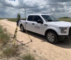
Once we are on site, we use professional grade GPS, total stations, and other instruments to collect precise measurements. We locate boundary markers, fences, buildings, driveways, utilities, and natural features, depending on the type of survey.
Back in the office, we analyze the field data together with the record documents. We resolve any conflicts, apply Texas boundary law, and prepare a final map and description that we sign and seal. That seal is what makes the work part of licensed land surveying services and gives it legal standing.
How Licensed Surveyors Protect Your Property Rights

Every property decision rests on one basic question. Where does this property begin and end? Licensed surveyors answer that question in a way that can stand up in a real estate closing, a permitting review, or even a courtroom.
Accurate surveys help to:
- Confirm that what you believe you are buying is what is legally described in the deed
- Identify encroachments such as fences or driveways that cross property lines
- Locate easements, rights of way, and building setback lines that can affect how you use the land
- Provide clear documentation if a boundary dispute arises later
Key Types Of Licensed Land Surveying Services
Licensed land surveying services cover a wide range of project types. The right survey depends on what you are trying to accomplish and what your lender, title company, or city requires.
Boundary And Title Surveys For Purchases And Sales
Boundary and title related surveys focus on confirming property lines for a specific parcel. For a standard home purchase, this often means a boundary or mortgage related survey that shows the lot, the house, the driveway, fences, and other improvements.
For commercial properties, lenders and title insurers frequently require an ALTA or NSPS land title survey. These surveys help buyers, sellers, and real estate professionals close with confidence.
Construction, Improvement, And Site Planning Surveys
When you are planning to build, expand, or renovate, builders and engineers depend on licensed land surveying services such as:
- Topographic surveys that map the shape of the land and existing features
- Foundation and layout surveys that verify planned structures are placed in the correct location
- As built surveys that document what was actually constructed
Accurate site information at the beginning can prevent change orders, redesign, and schedule issues later. At Southpoint Texas Surveying, we can help you explore the full range of services we offer for both design and construction support.
Elevation Certificates And Floodplain Related Surveys
In many parts of South Texas, floodplain and drainage questions are a central part of property decisions. Lenders and insurance providers often require an elevation certificate to determine flood insurance needs and premiums. In some cases, accurate elevation information can reduce insurance costs or support a request for a map amendment.
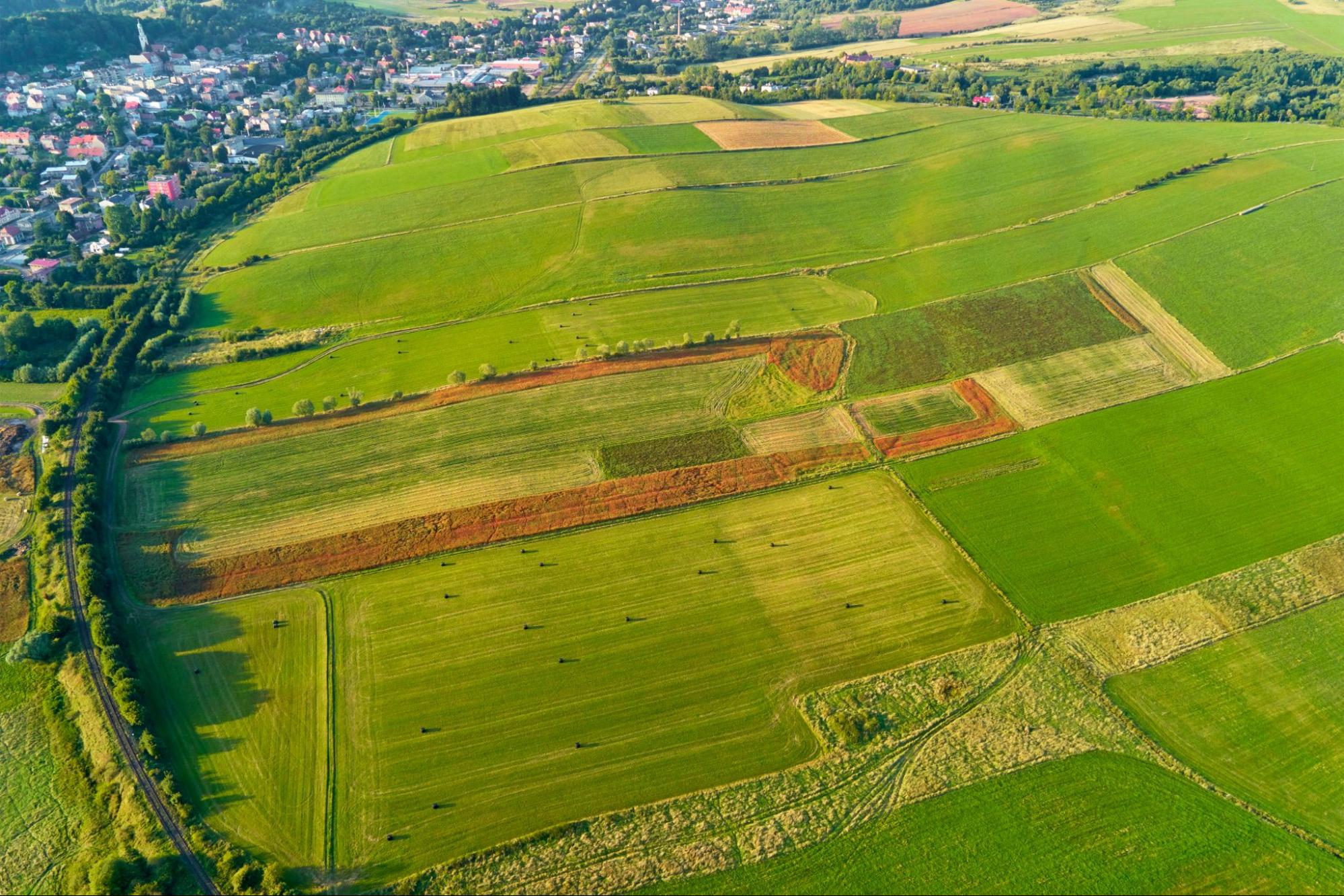
Rural Acreage, Ranch, And Subdivision Surveys
Large tracts bring their own challenges. Licensed land surveying services for these properties can include:
- Acreage boundary surveys for farm and ranch purchases
- Division surveys when a large tract is split into smaller parcels
- Preliminary and final subdivision surveys that support platting with the county or city
Protect Your Investment: The Power of Choosing a Licensed Surveyor
It can be tempting to view surveying as simple measurement work. In reality, a land survey combines technical measurement, legal interpretation, and professional judgment.
State Licensing, Training, And Professional Standards
In Texas, licensed surveyors meet specific education and experience requirements and must pass national and state examinations. They are regulated by a state board that enforces professional standards and ethical rules.
This framework requires licensees to maintain competency in measurement methods, mapping, and boundary law, follow accepted standards for different survey types, and place their professional seal on work products, which makes them directly responsible for accuracy.
Common Risks Of Using Unlicensed Or Inexperienced Providers
Using someone who is not properly licensed may seem less expensive at first, but it introduces real risk. Surveys that do not follow legal standards can be rejected by lenders or permitting authorities.
Common issues that arise from unqualified providers include corners set in the wrong location, missing or incorrect easements on the survey map, and incomplete documentation that a title company cannot accept. Correcting these issues later usually costs more than having the work done correctly the first time.
When You Need Licensed Land Surveying In South Texas
There are common situations when licensed land surveying services are strongly recommended or required.
Real Estate Transactions And Mortgage Requirements
Most lenders and title companies require a current survey before closing on a property. If you are under contract to buy property, ask early what kind of survey your lender and title company will accept to avoid closing delays.
Boundary Questions, Disputes, Or Encroachments
If a neighbor places a fence, shed, or driveway near what you believe is the property line, a licensed boundary survey is often the most direct way to bring clarity.
Planning New Construction, Additions, Or Fences
Any time you plan to build near a property line or a setback line, it is wise to confirm the boundary and applicable restrictions first. A proper survey can prevent costly corrections later if something is built over a line or too close to a setback.
Easements, Right-Of-Way, And Access Issues
Driveways that cross other properties, shared access roads, utility easements, and drainage ways all affect how land can be used. Licensed land surveying services can locate and map these features so that all parties understand their rights and obligations.
How The Land Surveying Process Works From Start To Finish

Gathering Records, Proposals, And Scheduling
The process starts with information. We review your goals, the property address or legal description, and any existing documents you have. We then research public records to gather plats, deeds, and easements, and prepare a proposal that explains the scope, estimated cost, and anticipated schedule.
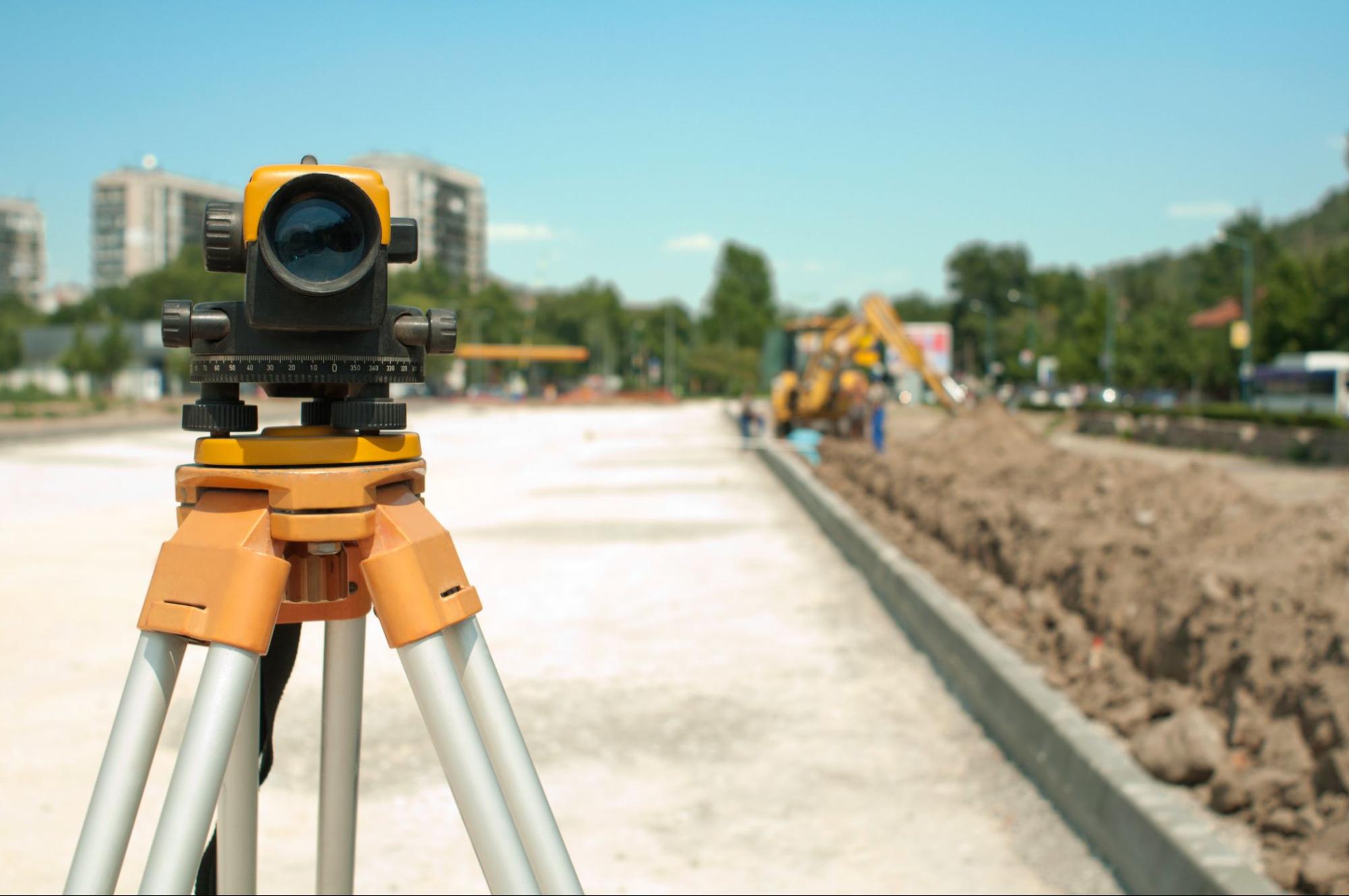
Field Work, Measurements, And On Site Markers
During the field phase, our crews visit the property to collect measurements, locating existing boundary monuments, iron rods, fences, walls, structures, utilities, and natural features. Where appropriate, we set new markers so that corners and key points can be found in the future.
Drafting, Review, And Delivering Your Final Survey
After field work is complete, we process the measurements and create a detailed map. The licensed surveyor signs and seals the survey, and we deliver it in the format your project requires. You can learn more about our survey services for specific survey types in greater detail.
Typical Timelines And Costs For Licensed Surveys
Key cost drivers include size of the property, density of development, condition of existing records, accessibility of the site, and type of survey required. A small residential lot with clear recent records will generally cost less than a large rural tract with older deeds.
You can help your survey stay on schedule by sharing any prior surveys, plats, and title work, confirming survey requirements before work begins, making sure the property is accessible, and allowing enough lead time before your closing or construction start.
Questions To Ask Before You Hire A Surveyor
Choosing the right provider for licensed land surveying services starts with a few straightforward questions:
- Are you currently licensed to practice land surveying in Texas
- What type of survey do you recommend for my situation
- How long do you expect the work to take
- Will the final survey meet my lender or title company requirements
A professional surveyor should be able to answer these questions clearly. If you are unsure which questions apply to your property, you can reach out to our team and we will walk through the options together.
Conclusion
Licensed land surveying services play a central role in nearly every property decision in South Texas. They confirm boundaries, document improvements, clarify easements and setbacks, and give buyers, sellers, lenders, and builders a shared, reliable picture of the land.
At Southpoint Texas Surveying, we are committed to providing accurate, timely, and dependable surveys for projects of all sizes. If you are preparing to buy, sell, build, or simply want clarity about your boundaries, we invite you to learn more about our survey services or contact us to discuss your property.
Licensed Land Surveying Services: Frequently Asked Questions
What are licensed land surveying services and why are they important?
Licensed land surveying services involve measuring, mapping, and documenting land and improvements so property boundaries are legally reliable. The signed and sealed survey is a legal document relied on by lenders, title companies, attorneys, and local governments.
When do I need a licensed land surveyor for my property in South Texas?
You typically need a licensed land surveyor for real estate purchases or refinances, boundary questions or disputes, planning new construction or fences near property lines, and resolving easement or access issues.
How much do licensed land surveying services usually cost?
Costs depend on property size, boundary length, terrain, development density, record quality, and the survey type required. Small residential lots with good records usually cost less than large rural tracts or detailed commercial and ALTA/NSPS surveys.
What types of surveys are included in licensed land surveying services?
Common survey types include boundary and mortgage-related surveys, ALTA/NSPS land title surveys, topographic and engineering surveys, elevation certificates and floodplain surveys, and ranch, acreage, and subdivision surveys.
How long does a land survey take from start to finish?
Simple residential surveys may take days to a couple of weeks, while complex commercial or large rural tracts can require several weeks from authorization to delivery.
How do I choose the right company for licensed land surveying services?
Ask whether the surveyor is currently licensed in Texas, what survey type they recommend, expected timelines, and whether the final survey will meet lender or title requirements.