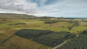
Property lines in Rio Grande City, TX aren’t always as clear as they seem. Between historic Spanish land grants, aging fence lines that don’t match legal boundaries, and the rapid growth happening along Highway 83, Starr County property owners face unique challenges that require professional expertise. A licensed land surveyor in Rio Grande City, TX brings the precision needed to protect your investment—whether you’re closing on a home near Ringgold, dividing agricultural acreage outside Roma, or building on a lot in the Las Lomas subdivision.
If you’ve never hired a surveyor before, you probably have questions. What type of survey does your lender or title company actually need? How do surveyors handle the older metes-and-bounds descriptions common in this part of the Rio Grande Valley? What should you expect to pay in Starr County compared to McAllen or Laredo?
This guide breaks it all down. We’ll cover when Rio Grande City property owners typically need surveys, the specific types used across South Texas, what the process involves from field work to final plat, and how to choose a surveyor familiar with local records at the Starr County Clerk’s office and the unique terrain of the Lower Rio Grande Valley.
Why You Might Need a Land Survey in Rio Grande City
There are a handful of situations where a land survey isn’t just helpful, it’s essential. If you’re purchasing property, your lender or title company will almost certainly require one before closing. But surveys aren’t only for buyers. Sellers, builders, and even long-time landowners benefit from having clear, documented property boundaries.
Here are some of the most common reasons property owners in Rio Grande City seek out a surveyor:
- Real estate transactions. Mortgage lenders need confirmation that the property boundaries match the legal description. Without a current survey, closings can stall.
- Boundary disputes. Fences, driveways, and structures don’t always line up with actual property lines. A professional survey provides the documentation needed to resolve these questions before they escalate.
- New construction or additions. Before pouring a foundation or adding a structure, you need to confirm setback requirements and ensure the improvement stays within your property limits.
- Subdivision or land division. If you’re splitting a parcel for sale or estate planning, a survey establishes the legal boundaries of each new tract.
- Flood zone determination. Parts of Starr County fall within FEMA flood zones. An elevation certificate — prepared by a licensed land surveyor, engineer, or architect — may be required for flood insurance purposes when a property falls within a FEMA Special Flood Hazard Area.
In many of these cases, the survey isn’t something you can skip or delay without consequences. It protects your investment, your timeline, and your peace of mind. If you’re unsure whether your situation calls for a survey, you can always reach out to our team to talk through the specifics.
Matching the Right Survey to Your Situation in South Texas

Every property transaction or project calls for a specific type of survey—and choosing the wrong one can cost you time and money. Here’s how we help clients across the Rio Grande Valley identify exactly what they need.
Settling Property Line Disputes? Start with a Boundary Survey
When neighbors disagree about where one property ends and another begins, a boundary survey provides the definitive answer. We locate the exact corners and lines using your property’s legal description, which is especially valuable when original markers have gone missing or shifted over the years.
Financing a Purchase? Expect a Mortgage Survey
Lenders don’t take chances. Before approving your loan, they’ll want a mortgage survey that confirms the boundaries and documents every improvement on the property—buildings, fences, driveways, the works. We prepare these surveys to give both you and your lender complete confidence in the transaction.
Planning Construction or Development? Request a Topographic Survey
Before breaking ground, engineers and architects need to understand what the land actually looks like. A topographic survey reveals elevation changes, drainage patterns, and existing structures—critical data that determines how water will move across the site and where grading work is required.
Closing a Commercial Deal? You’ll Likely Need an ALTA/NSPS Survey
For high-value or complex transactions, title companies and commercial lenders require something more rigorous. An ALTA/NSPS Land Title Survey combines boundary, improvement, and topographic data under strict national standards set by the American Land Title Association and the National Society of Professional Surveyors. The 2026 Minimum Standard Detail Requirements, which took effect February 23, 2026, govern how these surveys must be prepared.
Working with Agricultural Land? Consider a Farm and Ranch Survey
South Texas is defined by its sprawling agricultural properties, and these vast tracts demand a specialized approach. Whether you’re buying, selling, or developing rural land, a farm and ranch survey establishes accurate acreage and boundary data across challenging terrain.
To explore the full range of services we offer, including as-built surveys, engineering surveys, and digital terrain modeling, visit our services page.
What To Expect During the Surveying Process

If you’ve never had a property surveyed before, the process is simpler than most people expect. Here’s a general overview of what happens from the time you request a survey to when you receive your final report.
Step 1: Initial consultation. The surveyor will ask about your property, the purpose of the survey, and any deadlines you’re working with. This helps determine the right type of survey and gives you a realistic timeline.
Step 2: Research. Before anyone sets foot on your property, the surveyor reviews public records, deeds, plat maps, and any prior survey data. This background research is critical for accuracy, especially for older properties that may have incomplete or outdated records.
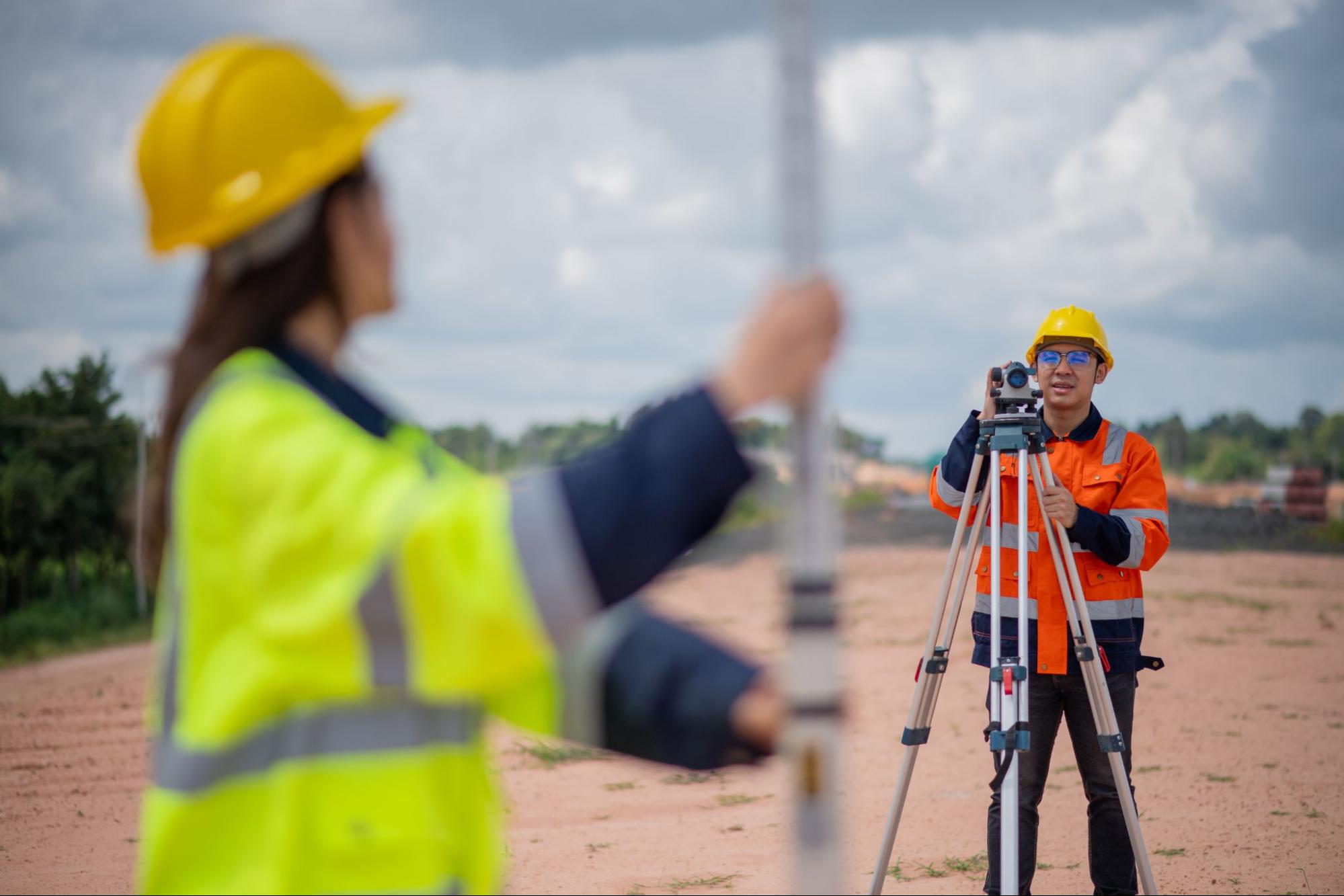
Step 3: Fieldwork. A survey crew visits the property to take measurements using GPS and conventional surveying equipment. They’ll locate boundary markers, map existing improvements, and collect elevation data if needed. Fieldwork can take anywhere from a few hours to a full day depending on the size and complexity of the property.
Step 4: Data analysis and drafting. Back in the office, the surveyor processes all collected data and prepares the official survey plat or map. This document shows boundary lines, dimensions, easements, and any encroachments or concerns.
Step 5: Delivery. You’ll receive your completed survey, typically within a few business days to a couple of weeks after fieldwork. If you need it sooner for a closing or permit deadline, let your surveyor know upfront so they can plan accordingly.
The whole process is designed to give you a clear, reliable picture of your property. And if questions come up along the way, a good surveyor will explain what they’re finding in plain language.
How To Choose the Right Land Surveyor in Rio Grande City, TX
Choosing a land surveyor in Rio Grande City, TX isn’t something most people do often, so it helps to know what to look for. A few key factors can make the difference between a seamless process and one that creates more questions than it answers.
Licensing and credentials. In Texas, land surveyors must be registered as a Professional Land Surveyor (RPLS) through the Texas Board of Professional Engineers and Land Surveyors (TBPELS). Always verify that the person or firm you’re hiring holds a current license.
Local experience. South Texas land has its own characteristics. From older Spanish land grants to rural agricultural tracts and newer residential developments, the history and terrain of this region require familiarity that only comes from working here. A surveyor who knows the Rio Grande Valley understands the local recording systems, common boundary issues, and the kinds of complications that can show up in Starr County properties.
Range of services. Some projects require more than a simple boundary survey. If your needs could expand, whether into topographic work, construction staking, or ALTA surveys, it’s worth choosing a firm that can handle all of it.
Communication and responsiveness. You want a surveyor who returns calls, explains findings clearly, and keeps you informed about timelines. Property transactions move fast, and delays on the survey side can hold up everything else.
At Southpoint Texas Surveying, we serve the Rio Grande Valley and all of South Texas with a commitment to accuracy, clear communication, and timely results. Our team uses both GPS technology and conventional surveying techniques to deliver dependable work for residential, commercial, and agricultural properties. You can browse our blog for related topics that cover everything from mortgage surveys to topographic assessments.
Conclusion

A land survey is one of those steps in the property process that’s easy to overlook until it becomes urgent. Whether you’re closing on a home, resolving a boundary concern, or planning a build in Rio Grande City, having accurate survey data protects both your investment and your timeline.
The right land surveyor in Rio Grande City, TX will bring local knowledge, proper credentials, and the ability to communicate findings in a way that actually helps you make decisions. You shouldn’t have to guess where your property lines are or wonder if a structure is properly placed.
If you have questions about an upcoming project or want to understand which type of survey fits your situation, contact us to discuss your property. At Southpoint Texas Surveying, we’re here to provide the clarity and documentation you need to move forward with confidence.Why do I need a land surveyor in Rio Grande City, TX?
A land surveyor in Rio Grande City, TX is essential for real estate transactions, resolving boundary disputes, new construction projects, land divisions, and flood zone determinations. Starr County properties—from lots near downtown Rio Grande City to rural acreage along the Rio Grande—often involve older subdivisions, agricultural tracts, and Spanish land grants that require accurate, professional surveying to avoid costly surprises.
What types of land surveys are available in Rio Grande City?
Common survey types include boundary surveys, mortgage surveys, topographic surveys, ALTA/NSPS land title surveys, and farm and ranch surveys. Southpoint Texas Surveying also offers as-built surveys, engineering surveys, foundation surveys, digital terrain modeling, and utility mapping to cover virtually any residential, commercial, or agricultural need in Starr County and the surrounding Rio Grande Valley.
How long does a land survey take in South Texas?
The timeline depends on property size and survey complexity. Fieldwork typically takes a few hours to a full day, and you can expect your completed survey within a few business days to a couple of weeks. If you have a closing or permit deadline, let your surveyor know upfront so they can plan accordingly.
How much does a land survey cost in Texas?
Survey costs vary based on property size, terrain, survey type, and the complexity of deed research required. A standard boundary or mortgage survey for a residential lot will cost less than an ALTA survey for a commercial property. Contact Southpoint Texas Surveying at (956) 368-5074 for a personalized quote.
What is the difference between a boundary survey and a mortgage survey?
A boundary survey identifies the exact corners and lines of a property using its legal description. A mortgage survey goes further by mapping all improvements on the property—such as buildings, fences, and driveways—giving lenders and title companies full confidence in what they are financing.
How do I choose a qualified land surveyor in Rio Grande City, TX?
Look for a Registered Professional Land Surveyor (RPLS) licensed in Texas with local experience in the Rio Grande Valley. Prioritize firms that offer a full range of services, use advanced GPS and conventional techniques, and communicate clearly. Southpoint Texas Surveying is locally owned, based in South Texas, and proudly serves Rio Grande City, Roma, La Grulla, and all surrounding communities with accurate, timely results.
Why should I have my land surveyed?
A professional land surveyor in Rio Grande City, TX helps you understand exact property boundaries before building, fencing, or selling. Surveys prevent costly disputes with neighbors and ensure compliance with local zoning laws. Whether you’re buying land in Starr County or planning a home addition, a survey protects your investment and provides peace of mind.
What are the different types of land surveys?
Common types include boundary surveys, topographic surveys, ALTA/NSPS surveys, and construction surveys. In Rio Grande City, TX, boundary surveys are popular for residential properties, while topographic surveys help builders assess elevation changes. A trusted local provider like Southpoint Texas Surveying, LLC can recommend the right survey type based on your specific needs and Starr County regulations.
What information is included in a land survey report?
A land survey report includes property boundaries, easements, encroachments, and legal descriptions. Rio Grande City, TX surveyors also document structures, fences, and utility locations on your property. This detailed report serves as an official record for real estate transactions, title insurance, and resolving boundary disputes with neighboring properties.
How long is a land survey good for?
Land surveys don’t technically expire, but changes to your property or surrounding areas may require an updated survey. In Rio Grande City, TX, most lenders and title companies typically accept surveys no older than 7 years. Surveys older than 10 years are almost always rejected, though a T-47 affidavit — a signed owner’s statement that no changes have occurred — can sometimes extend the usability of an older survey when paired with lender approval.
What should Rio Grande City, TX homeowners know about land surveying services?
Rio Grande City homeowners should hire licensed Texas surveyors familiar with Starr County property records and local terrain. Understanding your lot boundaries prevents fence disputes and ensures accurate property taxes. Whether you’re near the Rio Grande or in newer subdivisions, a qualified local surveyor like Southpoint Texas Surveying, LLC provides reliable measurements you can trust.
What is a property line and why does it matter?
A property line defines the legal boundaries of your land. In Rio Grande City, TX, knowing your property lines prevents encroachment issues with neighbors and ensures structures meet setback requirements. A licensed land surveyor accurately marks these boundaries, protecting your rights and helping avoid costly legal disputes down the road.
How do I hire a land surveyor I can count on?
Request references, verify their Texas Board of Professional Engineers and Land Surveyors (TBPELS) credentials, and get a detailed quote before committing to ensure quality service.