Unclear property lines can create problems that delay projects or complicate ownership. A boundary survey provides a clear picture of where a parcel begins and ends based on its legal description. This type of survey supports informed decisions for buyers, sellers, homeowners, and developers by confirming boundaries before plans move forward.
The work combines detailed research with precise field measurements. Surveyors review recorded deeds, plats, and historical documents, then compare that information with physical evidence found on the land. Corners and boundary lines are identified through existing monuments or by setting or restoring markers when needed. The outcome is a clear representation of property limits that aligns with the legal record.
What A Boundary Survey Establishes
This survey establishes property lines as written in the deed and supported by recorded documents. Surveyors analyze prior surveys, subdivision plats, easements, and rights of way to understand how the parcel fits within its surrounding area. Fieldwork then confirms those findings through measurements and physical evidence on site.
When original markers are missing or disturbed, surveyors rely on professional standards and supporting records to determine proper placement. This is what separates a legal boundary survey from informal measurements. The process reflects both technical accuracy and professional judgment, resulting in boundaries that can be relied upon for legal and planning purposes.
Common Situations Where It Is Needed
Many property owners request a survey during a purchase or sale, especially when required by lenders or title companies. Accurate boundaries help avoid surprises late in the transaction and support a smoother closing process.
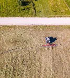
A residential boundary survey is also helpful when building fences, driveways, additions, or other improvements near property lines. It can clarify shared boundaries between neighbors and reduce the risk of encroachments. Larger tracts of land may require boundary verification before subdivision, development, or agricultural use.
How The Survey Process Works
The process begins with record research. Surveyors gather deeds, plats, and other documents tied to the property and surrounding parcels. This information is reviewed to understand boundary calls, distances, and historical intent.
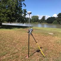
Next comes fieldwork. Using GPS and conventional surveying equipment, surveyors locate existing monuments and measure the property. The collected data is analyzed and compiled into a survey drawing that shows boundary lines, corner markers, and relevant improvements. This final document serves as an official reference for transactions, permitting, and future planning.
The Value Of Professional Accuracy
Accurate boundaries support property value, project planning, and peace of mind. Errors or assumptions about property lines can lead to disputes, delays, and added costs. Working with a licensed surveyor helps ensure boundaries are documented correctly and reflect current records and standards.
Clear, well documented property lines allow owners to move forward with confidence, whether planning improvements or completing a real estate transaction.
If you are ready to confirm your property boundaries or need documentation for an upcoming project, contact our team today to Get a Quote.