
Buying a home, adding a new room, or planning a backyard project should feel exciting, not stressful. Yet in South Texas, questions about where a property really begins and ends can slow everything down. That is where residential land surveying services become essential.
At Southpoint Texas Surveying, our residential land surveying services help property owners, buyers, and builders replace uncertainty with precise measurements and thorough documentation. In this guide, we cover what a residential land surveying services involves, when you need one, how the process unfolds, and how professional surveying protects your investment for years to come.
What A Residential Land Survey Is And Why It Matters
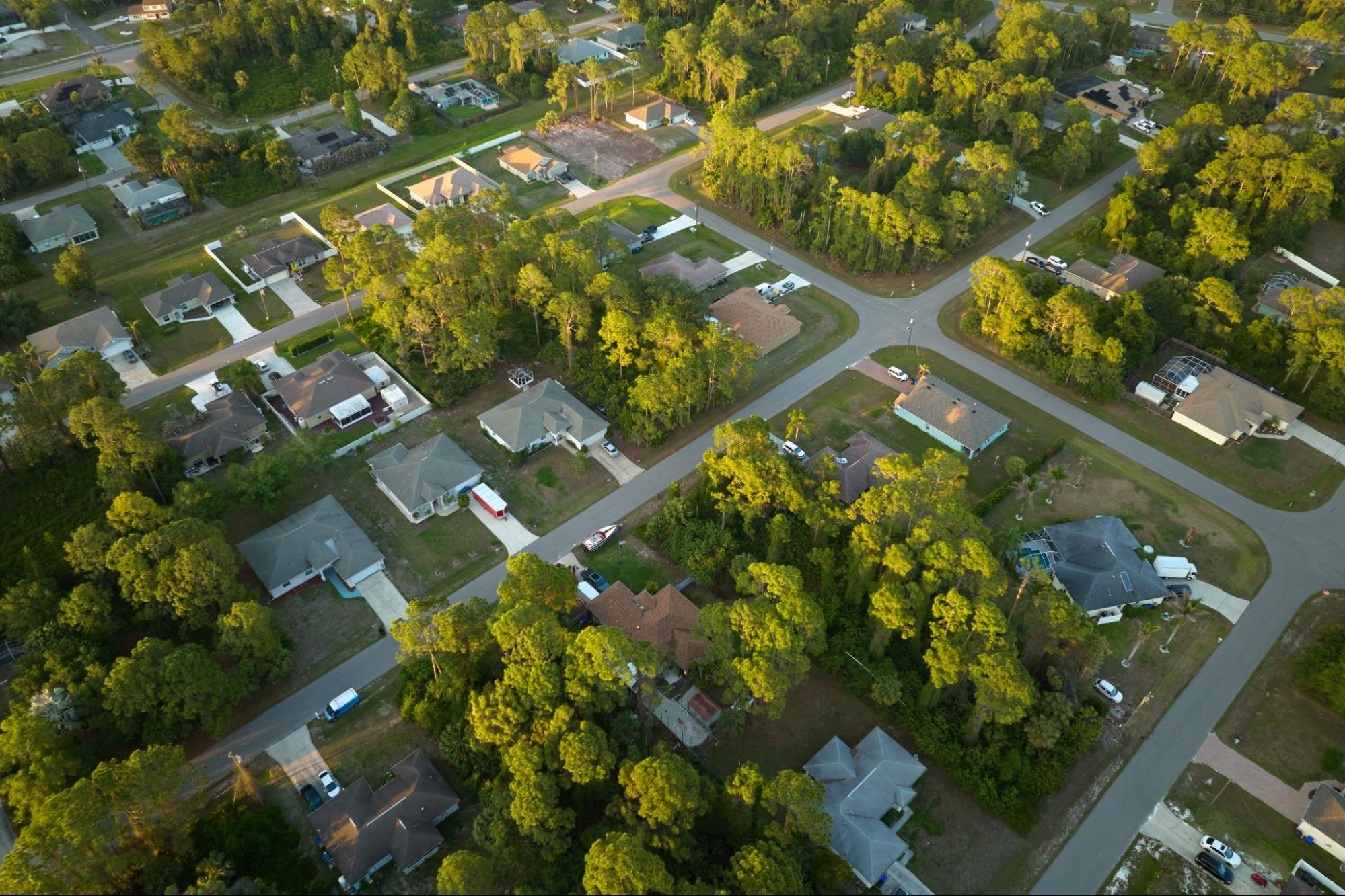
A residential land survey is a detailed measurement and map of a home site or residential lot. It shows property boundaries, the location of improvements such as the house, driveway, fences, and sheds, and important features like easements and utilities.
In simple terms, a survey answers three questions:
- What land do you legally own
- Where are the limits of that ownership on the ground
- What has been built on or across those limits
A licensed surveyor uses recorded documents such as deeds and plats, combined with precise field measurements, to prepare a signed and sealed survey drawing. Lenders, title companies, cities, and counties rely on this document because it ties legal descriptions on paper to real conditions on the ground.
For South Texas property owners, accurate residential land surveying services matter because they reduce the risk of boundary disputes, help prevent costly mistakes like building across a line or into an easement, support permits for improvements, and provide clarity during real estate closings.
Common Situations When You Need A Residential Survey
Many people first hear about land surveys when a lender or title company asks for one right before closing. In reality, there are several points in a property’s life where a residential survey is either required or highly recommended.
Typical situations include:
- Buying a home or lot A current survey may be required by your lender or title company. Even if not strictly required, a survey before closing can reveal encroachments or boundary issues before you sign.
- Selling a property Providing an up to date survey can make your listing more attractive and reduce last minute surprises that delay closing.
- Building a new home New construction usually requires staking and layout based on a boundary survey, as well as possible topographic information for design and drainage.
- Adding on to an existing home Projects such as room additions, garages, or patio covers need clear setback and easement information so the work complies with local regulations.
- Installing a pool, fence, or major landscaping Anything that goes near a property line or into a utility corridor should be checked against a survey first.
- Resolving a disagreement with a neighbor If there is a dispute over a fence line or use of a strip of land, a professional survey provides objective evidence of where the boundary lies.
If you are unsure whether your situation calls for a survey, you can browse our blog for related topics and deeper explanations of specific survey types and requirements in South Texas.
Types Of Residential Land Surveys Used In South Texas
Residential land surveying services cover several different survey types. The right option depends on what you plan to do with the property and what your lender, title company, or local jurisdiction requires.
Boundary Survey
A boundary survey establishes or confirms the exact location of your property lines. We use your deed, subdivision plat, and other records, then locate and set physical markers at corners or along lines. This survey is often used for verifying ownership limits, resolving encroachment questions, and supporting fence placement.
Mortgage Or Title Related Surveys
For many financed purchases, a lender or title company will require a survey that documents boundary lines and visible improvements. The goal is to confirm that the home and major structures sit within the property and do not appear to violate setbacks or easements.
Topographic Surveys
A topographic survey shows not only horizontal positions, but also elevations and contours. For residential sites, this information is valuable when designing new homes on sloping or flood prone land, planning grading and drainage features, and coordinating with engineers and architects.
What To Expect During The Survey Process

Understanding the survey process ahead of time can ease a lot of stress, especially if you are on a tight real estate or construction timeline.
Residential surveys usually follow these steps:
- Scope and proposal We start by asking about your property, your plans, and any deadlines. Based on that information, we define the type of survey you need and provide a written proposal.
- Records research Our team reviews deeds, subdivision plats, easements, and prior surveys to understand how your property fits into the surrounding area.
- Field work Survey crews visit the site, locate existing monuments, and take precise measurements using modern instruments and GPS combined with traditional methods.
- Calculations and analysis We evaluate how the field data matches the recorded information. Boundary decisions are based on legal principles and professional judgment.
- Drafting and review We prepare a detailed survey drawing and perform internal quality checks. The final product is signed and sealed by a licensed surveyor.
- Delivery and questions You receive a digital and printed copy of the survey. We are available to walk you through key features such as boundary lines, easements, and any encroachments.
Timeline, Costs, And Factors That Affect Your Quote
Many residential boundary or mortgage related surveys can be completed within several days to a few weeks. Scheduling depends on property size and complexity, how quickly we can obtain necessary records, and current workload and weather conditions.
Survey fees are based on the time and professional work required, not the value of the property. Common cost drivers include lot size and shape, terrain and vegetation, location and record quality, survey type and detail level, and any rush or litigation needs.
At Southpoint Texas Surveying, we explain these factors upfront so you know what is included in your quote. There are no hidden add ons.
How To Choose The Right Surveyor For Your Property
Choosing a surveyor is about more than finding the lowest price. Key points to consider include licensing and qualifications, local South Texas experience, range of services, clear communication style, and responsiveness to tight schedules.
At Southpoint Texas Surveying, we take these responsibilities seriously. Our goal is to provide reliable information, answer your questions, and support your decisions without adding pressure. If you have a specific project in mind, contact our team to discuss your property and project goals.
How Survey Results Protect You In Disputes And Future Projects

A completed survey is more than a drawing for your files. It is evidence that can protect your rights and guide your decisions for as long as you own the property.
In boundary or encroachment disputes, a professionally prepared survey documents how your boundary lines were established, identifies encroachments that cross lines or extend into easements, and provides a basis for discussions with neighbors or courts when needed.
For future projects, your survey shows setbacks and easements so architects and contractors can design within legal limits, helps builders avoid conflicts with underground utilities, and supports permit applications by giving cities and counties clear information.
Accurate residential land surveying services also make future transactions smoother. When you decide to sell, having a relatively recent survey often reduces closing complications and gives buyers added confidence.
Conclusion
Residential land surveying services give South Texas property owners a clear picture of where their property begins and ends, what has been built on it, and which legal limits apply. That clarity can prevent disputes, support smoother closings, and keep construction projects on track.
By understanding what a residential survey is, when you need one, and how the process works, you are better prepared to make informed decisions about buying, selling, or improving your property.
At Southpoint Texas Surveying, we are committed to providing accurate, dependable surveys that help you move forward with confidence.
Residential Land Surveying Services – Frequently Asked Questions
What are residential land surveying services and why are they important?
Residential land surveying services provide a precise map of your home or lot, showing property boundaries, improvement locations, easements, and sometimes topography. This clear documentation reduces boundary disputes, prevents building over lines or into easements, and supports permits, closings, and future projects.
When should I get a residential land survey for my property?
You should consider a residential land survey when buying or selling a home, building a new house, adding rooms or garages, installing pools or fences, subdividing lot lines, or resolving a boundary dispute with a neighbor. Surveys are also commonly requested by lenders and title companies before closing.
How much does a residential land survey cost and what affects the price?
Costs depend on time and professional effort, not property value. Key factors include lot size and shape, terrain and vegetation, location and record quality, survey type and detail level, and any rush requirements. Larger, irregular, or heavily wooded tracts usually cost more.
How do I choose the best residential land surveying services in South Texas?
Look for a licensed Texas surveyor with strong South Texas experience, familiarity with local plats and flood-prone areas, and a full range of boundary, topographic, and construction surveys. Prioritize clear communication, realistic turnaround times, and responsiveness.